- This page contains affiliate links. Purchases made through them may earn us a small fee.
Getting to Virgin Islands National Park
Driving to Virgin Islands
There are no roads or bridges to the island of St. John, although there is a car ferry connecting from St. Thomas. Once on St. John, the park lands are pretty easy to find, as they occupy most of the island. North Shore Road is the most heavily used by park visitors, as it provides access to nearly all of the famous beaches and bays. Centerline Road runs across the interior of the island, and connects the towns of Cruz Bay and Coral Bay.
If you’d like to plot directions from your location use the interactive map below. The marker shows the location of the Cruz Bay Visitor Center in Virgin Islands National Park.
Flying to Virgin Islands
Below you will find the only airport convenient for a trip to Virgin Islands. We provide direct links to browse available flights and cars. For price searches, simply enter your origin and dates.
Cyril E. King Airport (STT)
Located on St. Thomas, U.S. Virgin Islands, 16 miles by car to St. John (ferry required)
St. Thomas flight schedule and price search
St. Thomas available rental cars and price search
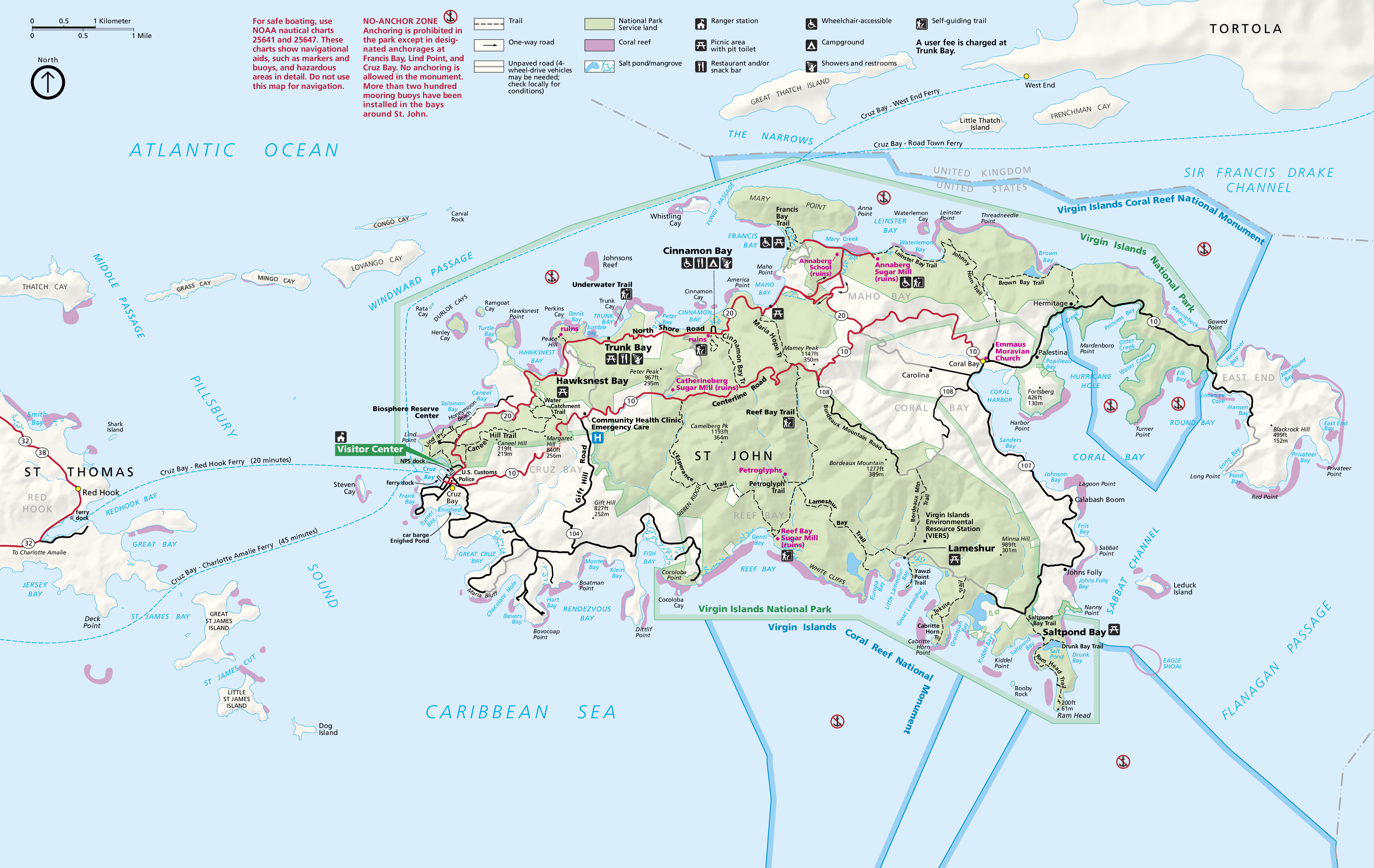
Official Park Map
Below is the official park map provided by the National Park Service. You can view either the original PDF file or a simple JPEG image file (some of these files can be quite large). Note that while this map is useful for general navigation around the park, if you plan to do any hiking, you should really have a proper Virgin Islands Trail Map.
