Hiking Trails in Arches
Arches’ small size, by national park standards, makes it one of the best for the day hiker. With the exception of a few little-used backcountry routes, Arches hiking is exclusively dayhiking, and most can be done in an hour or less. As short as most of these hikes are, it is important not to underestimate the effect of the desert sun and the arid climate, even in the cooler months. In summer, it is especially critical. Take water on any hike of any length.
Hiking distances given below are total, roundtrip distances unless otherwise stated. Difficulties are only a general guideline, for an adult in good condition, and do not take into account trail length. We strongly recommend you also have a good Arches Trail Map with you.
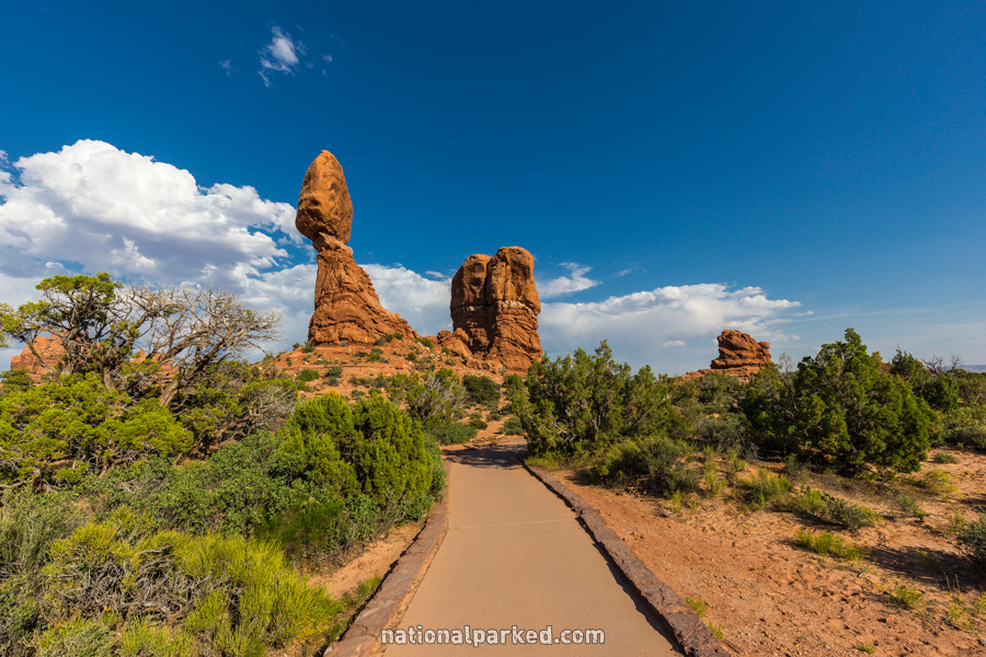
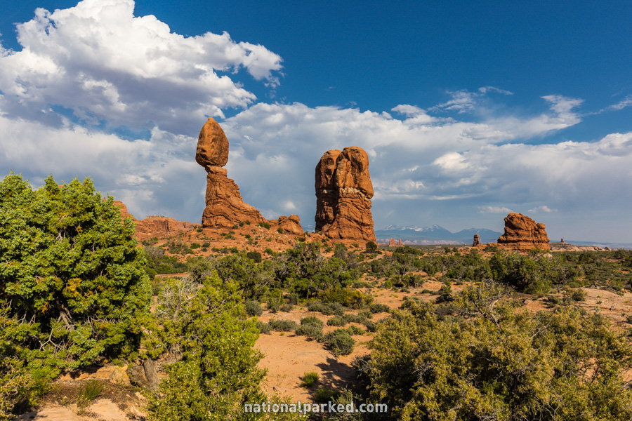
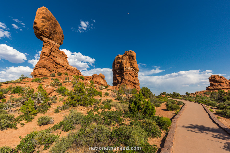
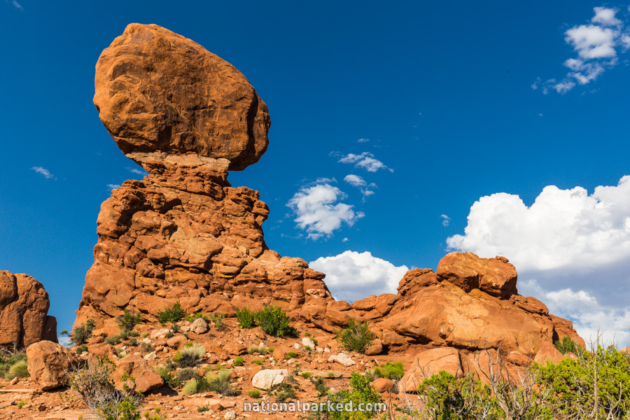
Balanced Rock
The Hike: This trail’s short distance and easy difficulty makes it one every visitor to Arches should do. Balanced Rock can be easily seen from the parking area and the road itself, but this brief trail circles it, giving good views from all angles. The trail is easily followed at all times, and is a great way to get out of the car for a moment without expending any effort.
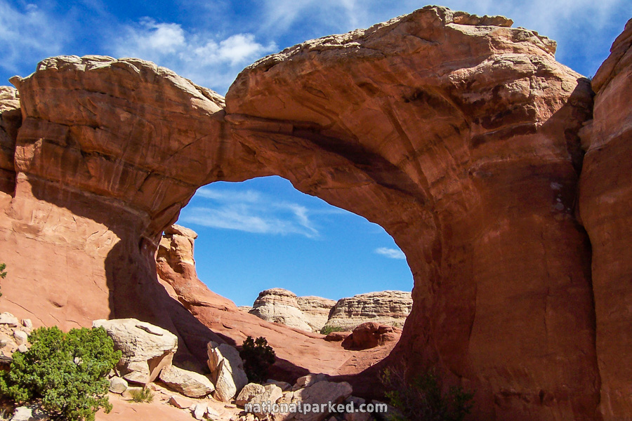
Broken Arch
The Hike: Broken Arch can actually be viewed two different ways. Most people will see it as a continuation of the hike to Sand Dune Arch lower on this page. Instead of taking the fork to the right that leads to Sand Dune Arch, bear left and continue almost half a mile to the base of Broken Arch. For those staying in Devil’s Garden Campground, there is an excellent hike coming from the other side that goes right under Broken Arch. There is a loop that continues on from here and returns to the campground at Site 51.
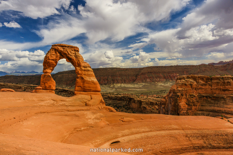
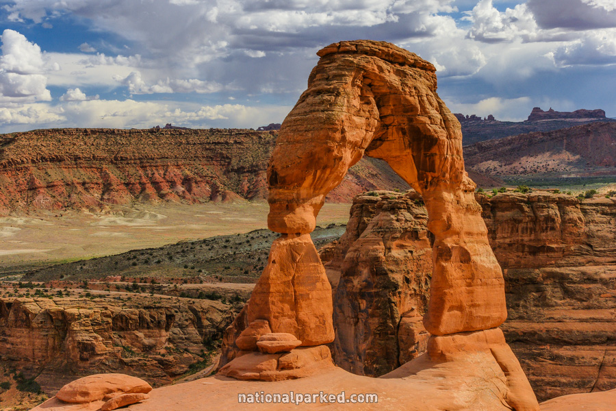
Delicate Arch
The Hike: If you choose only one hike in Arches, the trip to Delicate Arch would be a good selection. Its length and relative difficulty means it is not for everyone, and there are some steep dropoffs toward the end, making it potentially dangerous for children unless they are watched closely. The effort expended is well worth it, however, as this is one of the better designed trails in the park system. The last section is constructed so that Delicate Arch is hidden from view until you come out almost right in front of it. The awe of seeing Delicate Arch up close without an approaching view is one of the most spectacular experiences in the west. This hike is especially scenic in the late afternoon and evening, and is a very busy trail before sunset.
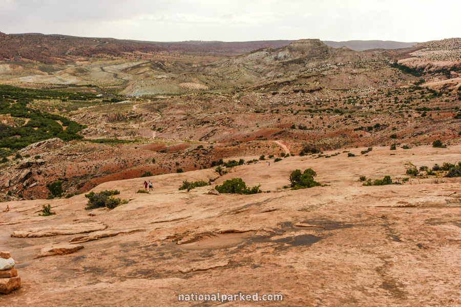
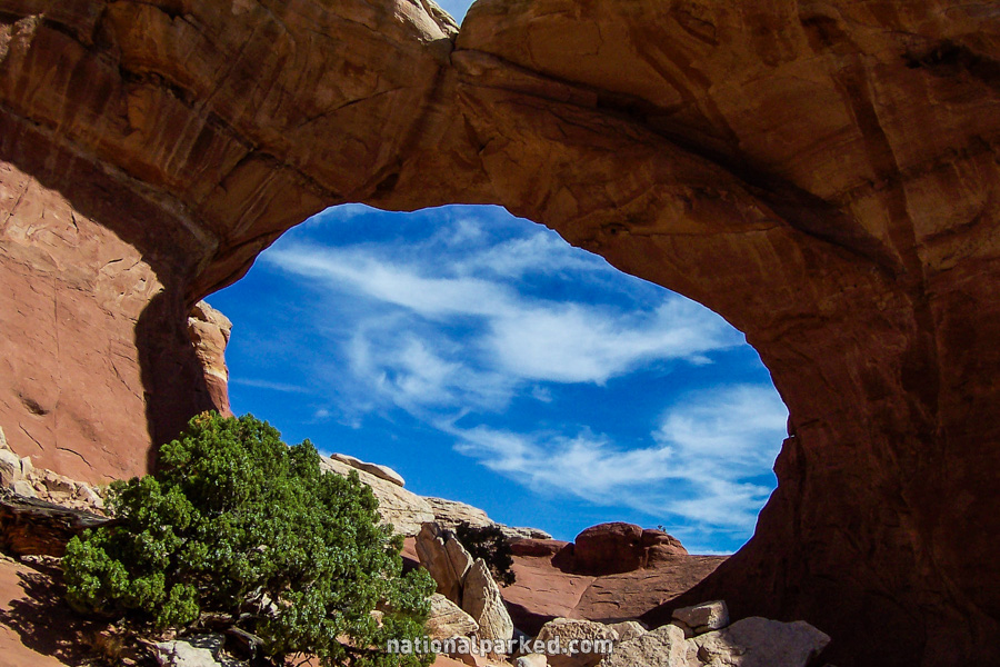
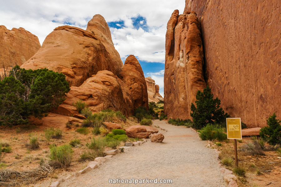
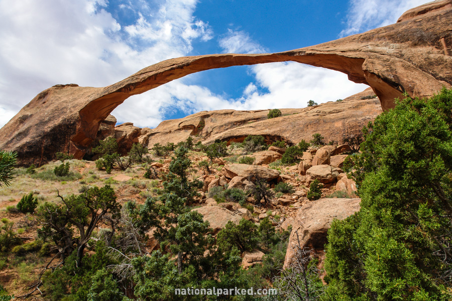
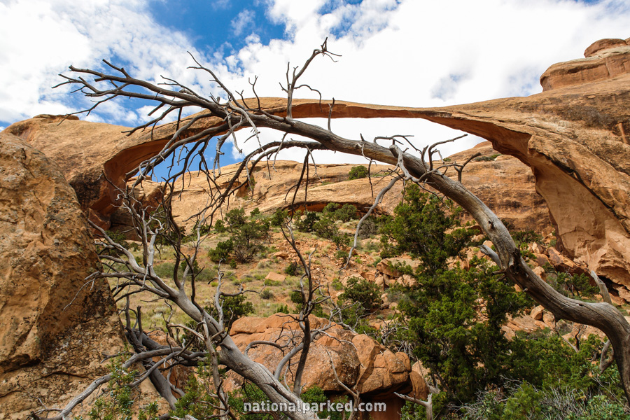
Devil’s Garden Trail System
The Hike: Devil’s Garden is a very popular area. Thanks to its size, it is not terribly crowded after the first bit of common trail. There are several spur trails of various lengths, so the area can get a little confusing at times. About a quarter of a mile from the parking area, the trail splits. To the right lie the short spurs to Pine Tree Arch and Tunnel Arch. To the left lies Landscape Arch, and beyond that, Double O Arch, Dark Angel, and the entire loop. Most people go no further than the amazing Landscape Arch, an opening of 306 feet, making it probably the longest stone arch in the world. The roundtrip distance to it is about two miles. A trail map is recommended for anyone going deeper into this area than Landscape Arch. The trail is difficult at times, and not well defined in spots.
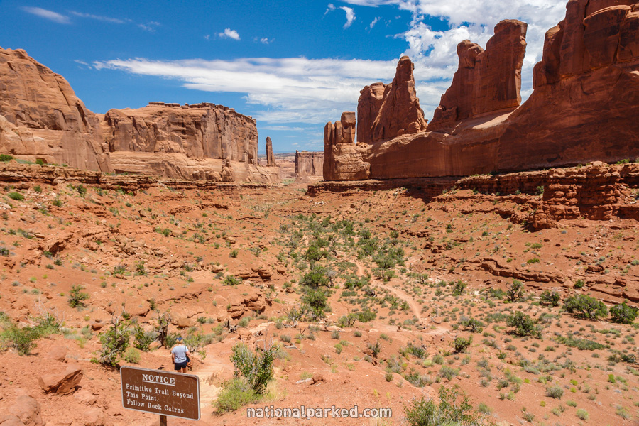
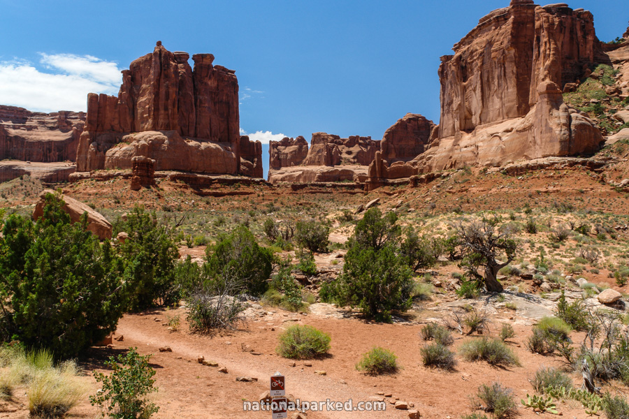
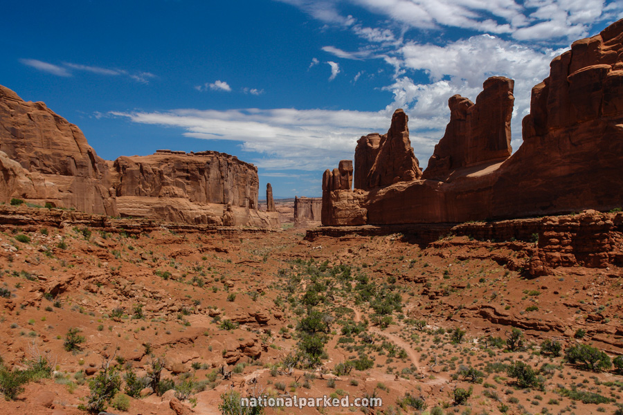
Park Avenue
The Hike: Starting from the Park Avenue parking area, the first bit of “trail” is actually concrete sidewalk, leading to the overlook. A set of stairs leads down from the overlook into the canyon, or “avenue” below. Once at the bottom, there really isn’t a trail any more, as the route is over mostly slickrock. There’s no real danger of being lost though, since the route is hemmed in by rock walls, and the start and finish is visible most all of the time. This hike is highly recommended, and if the shuttle can be arranged, it becomes a must.
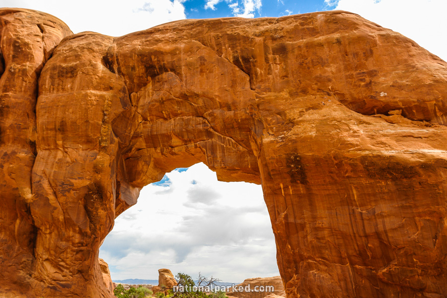
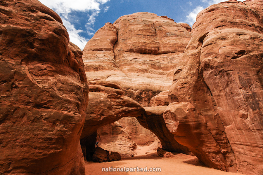
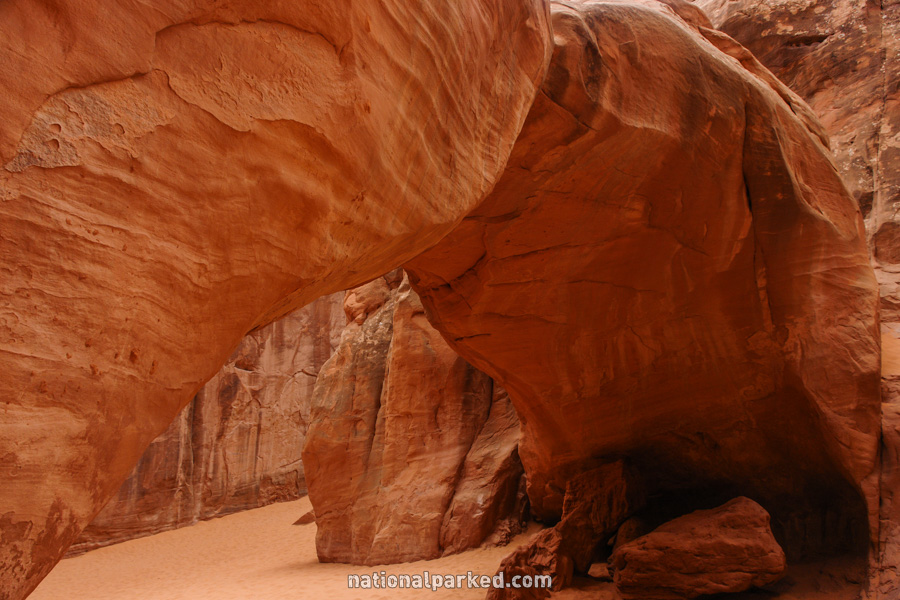
Sand Dune Arch
The Hike: Sand Dune Arch is a beautiful arch in a unique area. Even on a blazing hot summer day, this arch is usually shaded and relatively cool. The trail leaves from the parking area and is one with the Broken Arch trail until it splits off to the right. It quickly goes through a very narrow break in the sandstone wall and enters a cool area filled with deep sand. Hiking through this deep, dry sand can be a bit strenuous, but it is very short. Sand Dune Arch will quickly appear on the right. One can walk right under the arch and even climb on top of it with some effort, but this is not recommended. The NPS has had to rescue several people in this area after falling or getting stuck on top.
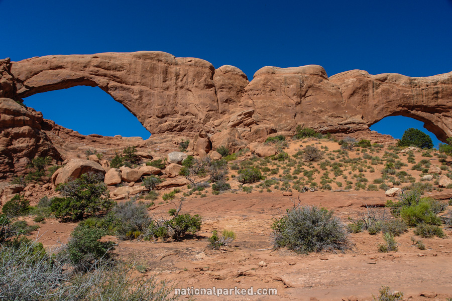
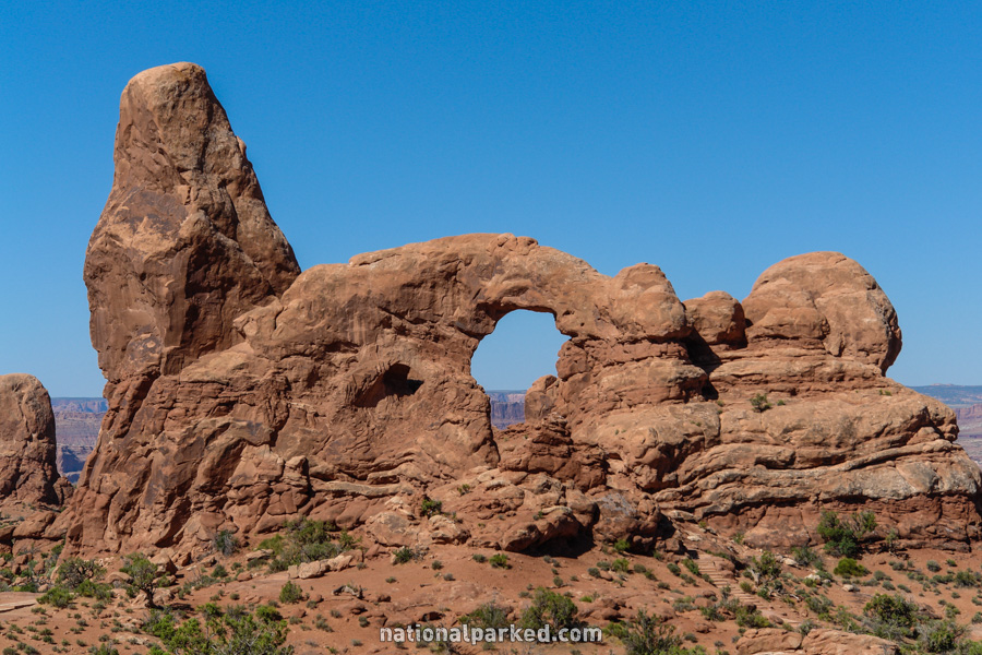
The Windows & Turret Arch
The Hike: A word of warning is in order before proceeding with the hike description. This is probably the most crowded area in the park. A parking spot may be hard to find any time except winter, and hordes of people are almost guaranteed. There is a good reason for this of course. The Windows and nearby Turret Arch are spectacular sights, and the excellent loop trail is very scenic. Rather than passing on this one, try to visit very early or late in the day. The trail leads easily to Turret Arch, North Window, and then South Window. The loop trail circles to the back, allowing a good look at why the Windows are frequently called the Spectacles.