- This page contains affiliate links. Purchases made through them may earn us a small fee.
Getting to Arches National Park
Driving to Arches
All road access to Arches is via the lone entrance road off of US Highway 191, known as the Arches Scenic Drive. Most people come from the north off of Interstate 70. Exit 180 is the US191 exit. Follow US191 south for 26 miles to the Arches entrance. If coming from the south, simply follow US191 until reaching Moab and pass through town. The entrance is about 5 miles north of town.
If you’d like to plot directions from your location use the interactive map below. The marker shows the location of the Visitor Center in Arches.
Flying to Arches
Arches isn’t especially close to any commercial airports, with the exception of Canyonlands Field (CNY). It has recently started to have some sporadic service by United Express, but we’re not yet listing it as a real option. If your only destination is Arches and nearby Canyonlands, it may be worth looking at CNY. Salt Lake City remains the nearest major airport.
Below you will find a list of airports most convenient for a trip to Arches, listed in order of distance. For each airport we provide direct links to browse available flights and cars. For price searches, simply enter your origin and dates.
Grand Junction Regional Airport (GJT)
Located in Grand Junction, Colorado, 109 miles by car to Arches
Grand Junction flight schedule and price search
Grand Junction available rental cars and price search
Montrose Regional Airport (MTJ)
Located in Montrose, Colorado, 149 miles by car to Arches
Montrose flight schedule and price search
Montrose available rental cars and price search
Salt Lake City International Airport (SLC)
Located in Salt Lake City, Utah, 234 miles by car to Arches
Salt Lake City flight schedule and price search
Salt Lake City available rental cars and price search
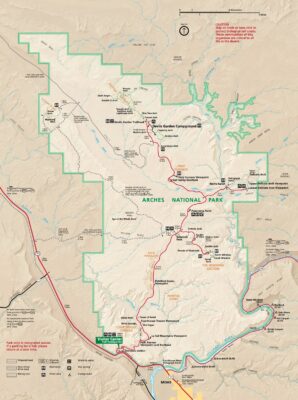
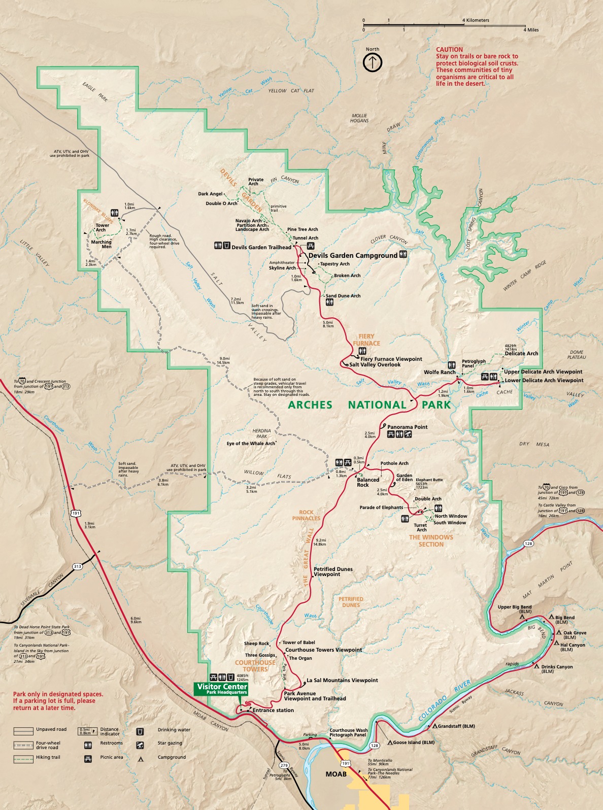
Official Park Map
Below is the official park map provided by the National Park Service. You can view either the original PDF file or a simple JPEG image file (some of these files can be quite large). Note that while this map is useful for general navigation around the park, if you plan to do any hiking, you should really have a proper Arches Trail Map.