- This page contains affiliate links. Purchases made through them may earn us a small fee.
Getting to Voyageurs National Park
Driving to Voyageurs
International Falls is the closest city to Voyageurs National Park. It is an 8 mile drive on MN-11 to the Rainy Lake area. It is about 30 minutes east on US-53 to get to the Kabetogama Lake area.
If you’d like to plot directions from your location use the interactive map below. The marker shows the location of the Rainy Lake Visitor Center in Voyageurs.
Flying to Voyageurs
Voyageurs is located in far northern Minnesota, and with the exception of the tiny airport in International Falls, places to fly into are quite distant.
Below you will find a list of airports most convenient for a trip to Voyageurs, listed in order of distance. For each airport we provide direct links to browse available flights and cars. For price searches, simply enter your origin and dates.
International Falls Airport (INL)
Located in International Falls, Minnesota, 16 miles by car to Voyageurs
International Falls flight schedule and price search
International Falls available rental cars and price search
Duluth International Airport (DLH)
Located in Duluth, Minnesota, 169 miles by car to Voyageurs
Duluth flight schedule and price search
Duluth available rental cars and price search
Minneapolis−Saint Paul International Airport (MSP)
Located near Minneapolis, Minnesota, 309 miles by car to Voyageurs
Minneapolis flight schedule and price search
Minneapolis available rental cars and price search
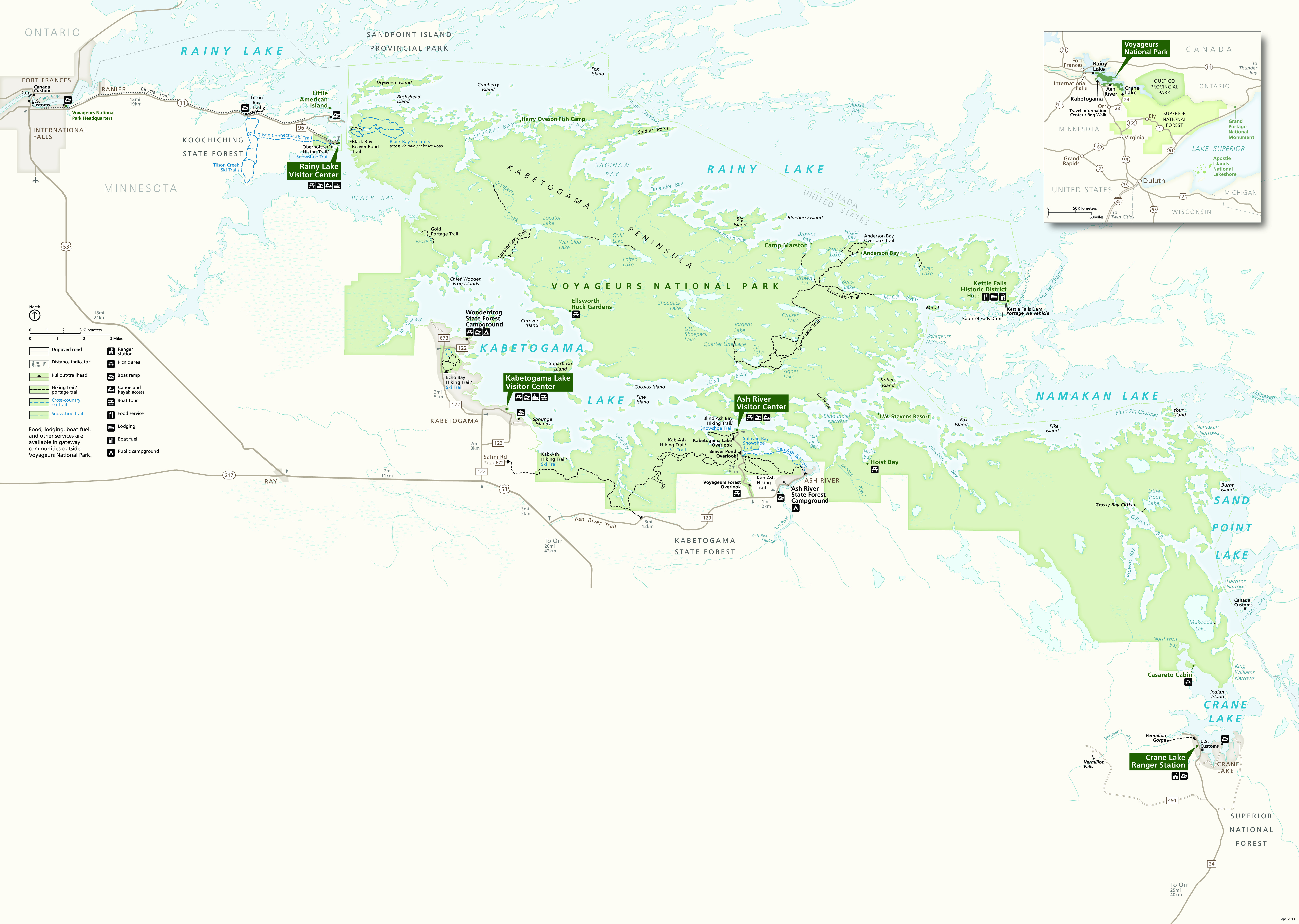
Official Park Map
Below is the official park map provided by the National Park Service. You can view either the original PDF file or a simple JPEG image file (some of these files can be quite large). Note that while this map is useful for general navigation around the park, if you plan to do any hiking, you should really have a proper Voyageurs Trail Map.
