- This page contains affiliate links. Purchases made through them may earn us a small fee.
Getting to New River Gorge National Park
Driving to New River Gorge
There are two main roads that visitors use to access the park. US-19 connects Beckley and Hico, crossing the famous New River Gorge Bridge on the way. Interstate 64 crosses through the park down in the Sandstone region. It’s important not to rely on GPS once off the main roads, as it sometimes guides you to rough dirt roads and other remote areas.
If you’d like to plot directions from your location use the interactive map below. The marker shows the location of the Canyon Rim Visitor Center in New River Gorge National Park.
Flying to New River Gorge
There’s really only one airport within decent range of New River Gorge, and that is Charleston, West Virginia. For this airport we provide direct links to browse available flights and cars. For price searches, simply enter your origin and dates.
West Virginia International Yeager Airport (CRW)
Located in Charleston, West Virginia, 60 miles by car to Canyon Rim Visitor Center
Charleston flight schedule and price search
Charleston available rental cars and price search
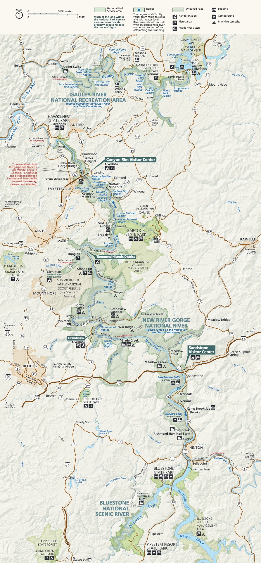
Official Park Map
Below is the official park map provided by the National Park Service. You can view either the original PDF file or a simple JPEG image file (some of these files can be quite large). Note that while this map is useful for general navigation around the park, if you plan to do any hiking, you should really have a proper New River Gorge Trail Map.