- This page contains affiliate links. Purchases made through them may earn us a small fee.
Getting to Indiana Dunes National Park
Driving to Indiana Dunes
Indiana Dunes National Park is locator along the shores of Lake Michigan, and was just recently elevated from National Lakeshore to National Park. It’s very close to several urban areas, including Gary, Indiana, and the massive metropolitan area of Chicago. Interstate 94 runs right past the park, and provides the easiest access from distant origins.
If you’d like to plot directions from your location use the interactive map below. The marker shows the location of the visitor center at Indiana Dunes.
Flying to Indiana Dunes
Below you will find a list of airports most convenient for a trip to Indiana Dunes, listed in order of distance. For each airport we provide direct links to browse available flights and cars. For price searches, simply enter your origin and dates.
South Bend International Airport (SBN)
Located in South Bend, Indiana, 43 miles by car to Indiana Dunes
South Bend flight schedule and price search
South Bend available rental cars and price search
Chicago Midway International Airport (MDW)
Located in Chicago, Illinois, 51 miles by car to Indiana Dunes
Chicago Midway flight schedule and price search
Chicago Midway available rental cars and price search
Chicago O’Hare International Airport (ORD)
Located in Chicago, Illinois, 64 miles by car to Indiana Dunes
Chicago O’Hare flight schedule and price search
Chicago O’Hare available rental cars and price search
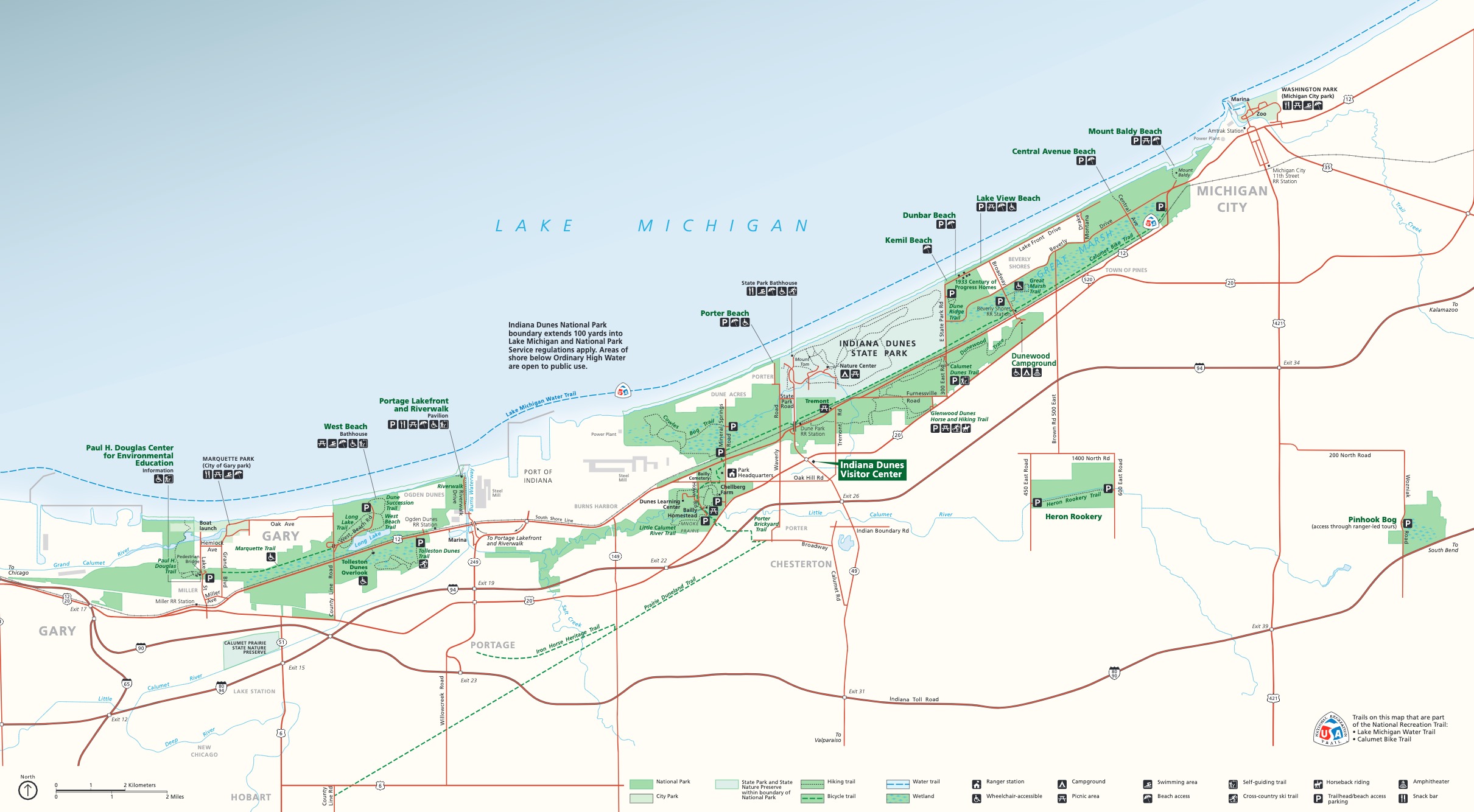
Official Park Map
Below is the official park map provided by the National Park Service. You can view either the original PDF file or a simple JPEG image file (some of these files can be quite large).
