Bryce Canyon Road Part 1
The Bryce Canyon Road, the extension of Utah Route 63, covers 17.4 miles within the park. We break this into two sections. This section covers the beginning, from the park entrance sign to the Rainbow Gate. This is where the road is normally closed during winter months. Although this first section is less than 3 miles long, it contains virtually all of the visitor services in the park, as well as the views of the classic Bryce Amphitheater. For coverage of the rest of the road, to its end at Rainbow Point, see Bryce Canyon Road Part 2.
Mile 0.0 – Park Entrance
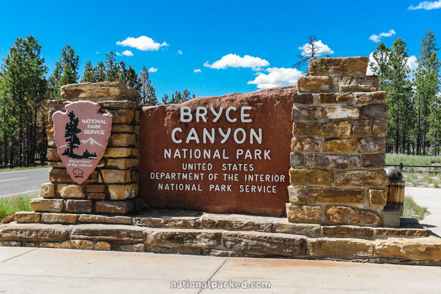
Just over a mile past the Ruby’s Inn complex is the entrance sign welcoming you to Bryce Canyon National Park. For more information on the Ruby’s Inn area, see Bryce Canyon Lodging.
Mile 0.3 – Fairyland Canyon Road
Shortly after, a road heads off to the left towards Fairyland Canyon. This area is a sort of “free preview” of Bryce Canyon, a very scenic area accessible before the entrance station. The Fairyland Loop Trail, a long and fairly difficult hike, begins and ends here. The Rim Trail also begins (or ends) here. See Bryce Canyon Hiking.
Mile 1.1 – Entrance Station
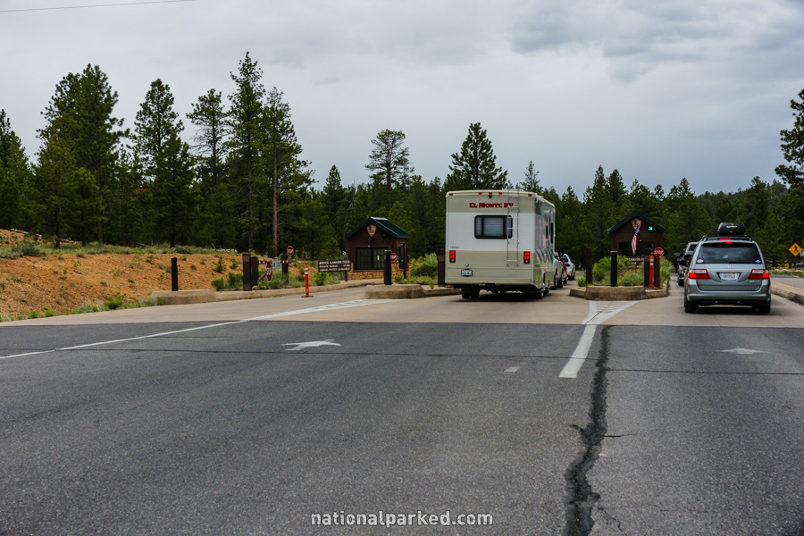
The road passes through the entrance station here. The park entrance fee must be paid or a valid pass shown.
Mile 1.2 – Visitor Center
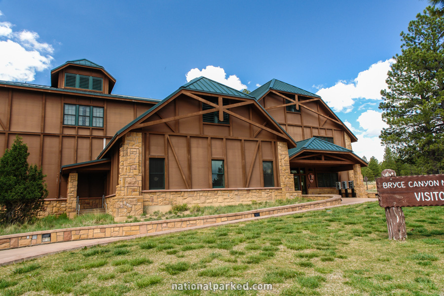
The large Bryce Canyon Visitor Center lies on the right side of the road. As usual, this stop is a must, especially for anyone new to the park. In addition to an array of exhibits, there is a bookstore and a theater showing an introductory movie to the Bryce Canyon area.
Mile 1.3 – North Campground
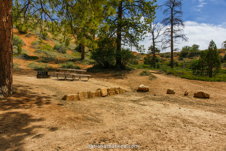
Just past the visitor center, on the opposite side of the road, is an entrance to the North Campground. This is the one of two campgrounds in the park, and is at least partially open all year. For more information see Bryce Canyon Camping.
Mile 1.5 – Sunrise Point & more
Another road goes off to the left, into a somewhat confusing area. It is actually a half circle, the other end of which is described below. The first left off of this road forms a second half circle, leading to North Campground and a picnic area, a general store, access to the Rim Trail, and finally Sunrise Point, pictured at left, before rejoining the first half circle. At Sunrise Point is the access to the Queen’s Garden Trail.
Mile 2.2 – Bryce Canyon Lodge & more
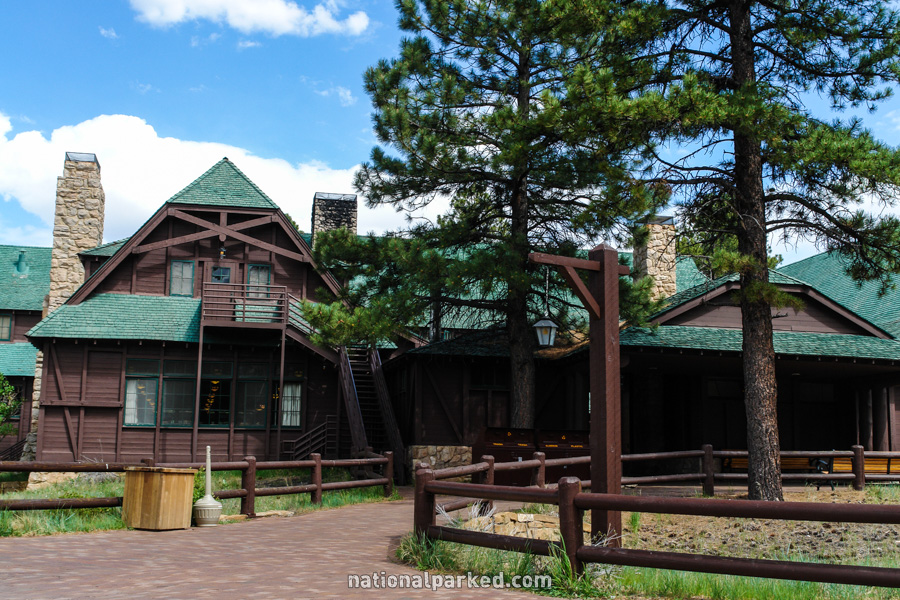
This road is marked as the access road to the Bryce Canyon Lodge, the only lodging available inside the park. It is really the back half of the half circle road described above, and can be used to go to all of the same destinations.
Mile 2.3 – Sunset Point
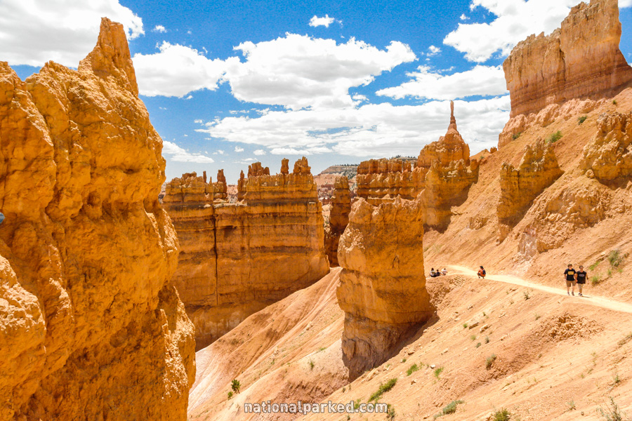
A road signed for Sunset Point goes to the left. As its name implies, this is a good spot to watch the sunset, although most of Bryce’s viewpoints are set up for good sunset viewing. The Navajo Loop Trail, the top of which is shown to the left, begins at Sunset Point, and the Rim Trail passes by it. To see more photos and information on these trails, see Bryce Canyon Hiking.
Mile 2.4 – Sunset Campground
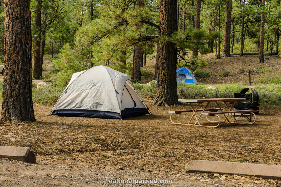
A road to the right leads to Sunset Campground. Trailers are not allowed beyond this point. For more on the campground see Bryce Canyon Camping.
Mile 2.8 – Road to Viewpoints
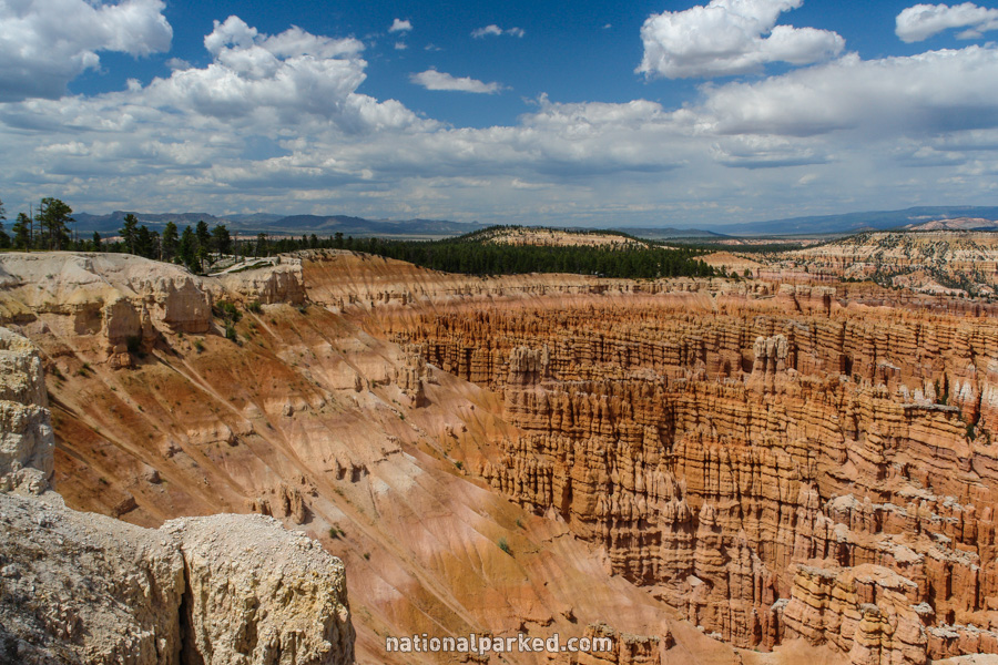
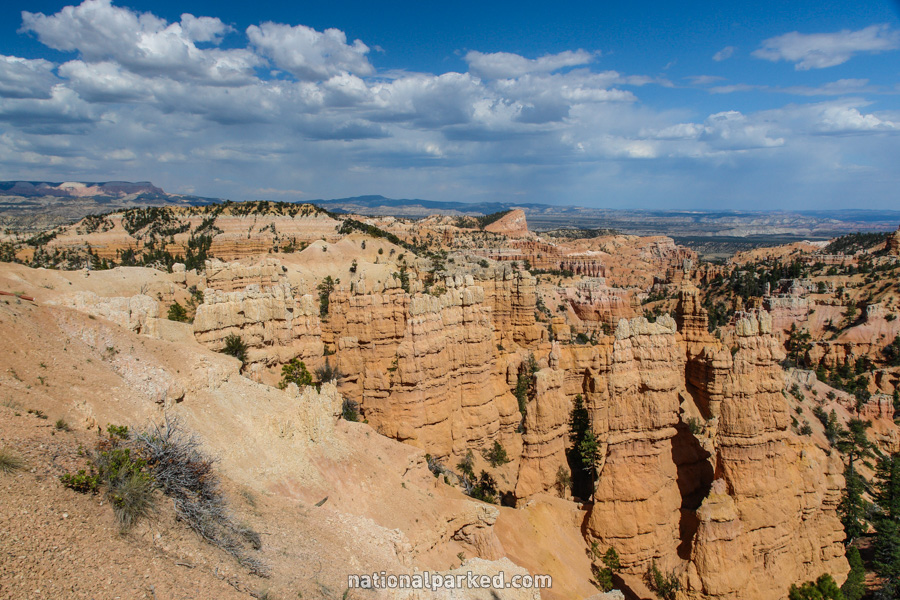
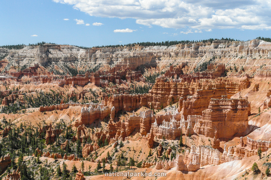
A well-marked road to the left leads to three major viewpoints of the Bryce Amphitheater. Immediately past this road is the Rainbow Gate, where the road is closed most of the winter. Quickly on the spur road is a left turn toward Inspiration Point.
A mile beyond the turnoff to Inspiration is a fork in the road. The right fork leads to Paria View. The left fork leads just over half a mile to the exceptional Bryce Point. This viewpoint offers both amazing views and a number of hiking options. This is the upper end of the Rim Trail. Another relatively long and difficult day hike loop, the Peekaboo Loop Trail, begins here as well.
The Bryce Canyon Road continues on
For the continuation of the road to its end at Rainbow Point, see Bryce Canyon Road Part 2.