- This page contains affiliate links. Purchases made through them may earn us a small fee.
Getting to Mount Rainier National Park
Driving to Mount Rainier
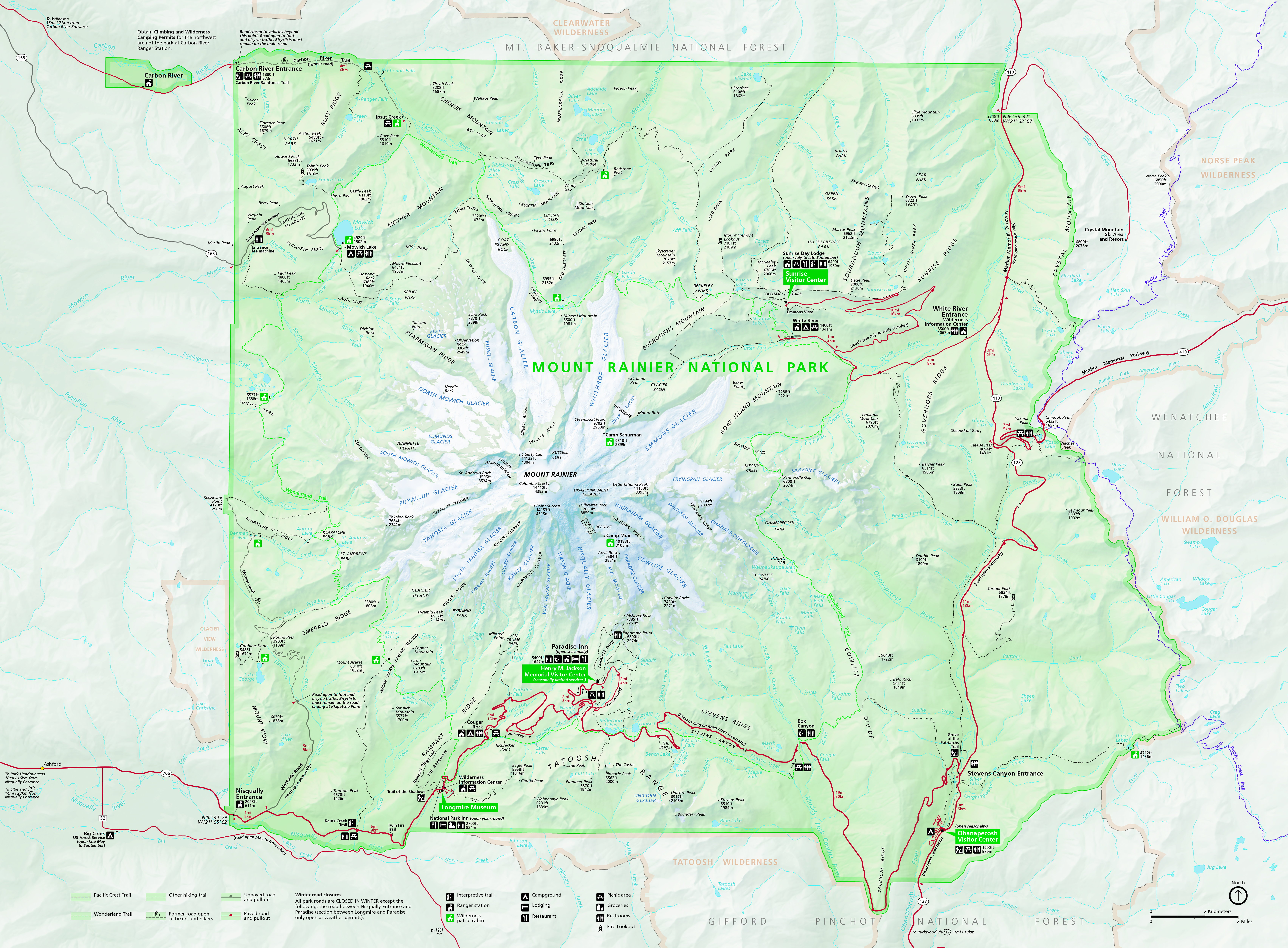
Road access to Mount Rainier is available from several points. Some of the more minor access areas are closed at the park boundary, and most access is closed in winter. Most people access the park from one of three entry points. The first is the Nisqually Entrance, the continuation of WA-706. It is reached from WA-7 and goes through the town of Ashford on its way. The second is via WA-123 from the south, which comes off of US-12 and enters the park quickly, soon coming to the Stevens Canyon Entrance. The last is WA-410 from the north, otherwise known as the Mather Memorial Parkway. Only the Nisqually Entrance provides significant access to the park year-round. The rest of the park roads are buried in snow at least November through May, and sometimes longer.
If you’d like to plot directions from your location use the interactive map below. The marker shows the location of the Henry M. Jackson Visitor Center at Paradise in Mount Rainier.
Flying to Mount Rainier
Below you will find a list of airports most convenient for a trip to Mount Rainier, listed in order of distance. For each airport we provide direct links to browse available flights and cars. For price searches, simply enter your origin and dates.
Seattle-Tacoma International Airport (SEA)
Located in Seattle, Washington, 82 miles by car to Mount Rainier
Seattle flight schedule and price search
Seattle available rental cars and price search
Portland International Airport (PDX)
Located in Portland, Oregon, 138 miles by car to Mount Rainier
Portland flight schedule and price search
Portland available rental cars and price search
Vancouver International Airport (YVR)
Located in Vancouver, British Columbia, Canada, 222 miles by car to Mount Rainier
Vancouver flight schedule and price search
Vancouver available rental cars and price search
Official Park Map
Below is the official park map provided by the National Park Service. You can view either the original PDF file or a simple JPEG image file (some of these files can be quite large). Note that while this map is useful for general navigation around the park, if you plan to do any hiking, you should really have a proper Mount Rainier Trail Map.