- This page contains affiliate links. Purchases made through them may earn us a small fee.
Getting to Yosemite National Park
Driving to Yosemite
There are four main highway access roads to Yosemite National Park, three of which are generally open all year. From the south, out of Fresno, take CA-41 north through Oakhurst to the South Entrance. From the west, two routes are available. The more southern of the two takes CA-140 east through Merced and Mariposa to the El Portal Entrance. The more northern of the two takes CA-120 east through Manteca to the Big Oak Flat Entrance. The last, and probably most scenic, entrance route is open generally late May to early November. Take CA-120 west from US395 in Lee Vining, arriving at the Tioga Pass Entrance at over 9,900 feet.
If you’d like to plot directions from your location use the interactive map below. The marker shows the location of the Yosemite Valley Visitor Center in Yosemite National Park.
Flying to Yosemite
Below you will find a list of airports most convenient for a trip to Yosemite, listed in order of distance. For each airport we provide direct links to browse available flights and cars. For price searches, simply enter your origin and dates.
Fresno Yosemite International Airport (FAT)
Located in Fresno, California, 95 miles by car to Yosemite Valley
Fresno flight schedule and price search
Fresno available rental cars and price search
Sacramento International Airport (SMF)
Located in Sacramento, California, 174 miles by car to Yosemite Valley
Sacramento flight schedule and price search
Sacramento available rental cars and price search
San Francisco International Airport (SFO)
Located in San Francisco, California, 191 miles by car to Yosemite Valley
San Francisco flight schedule and price search
San Francisco available rental cars and price search
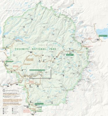
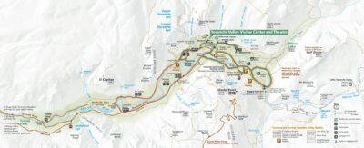
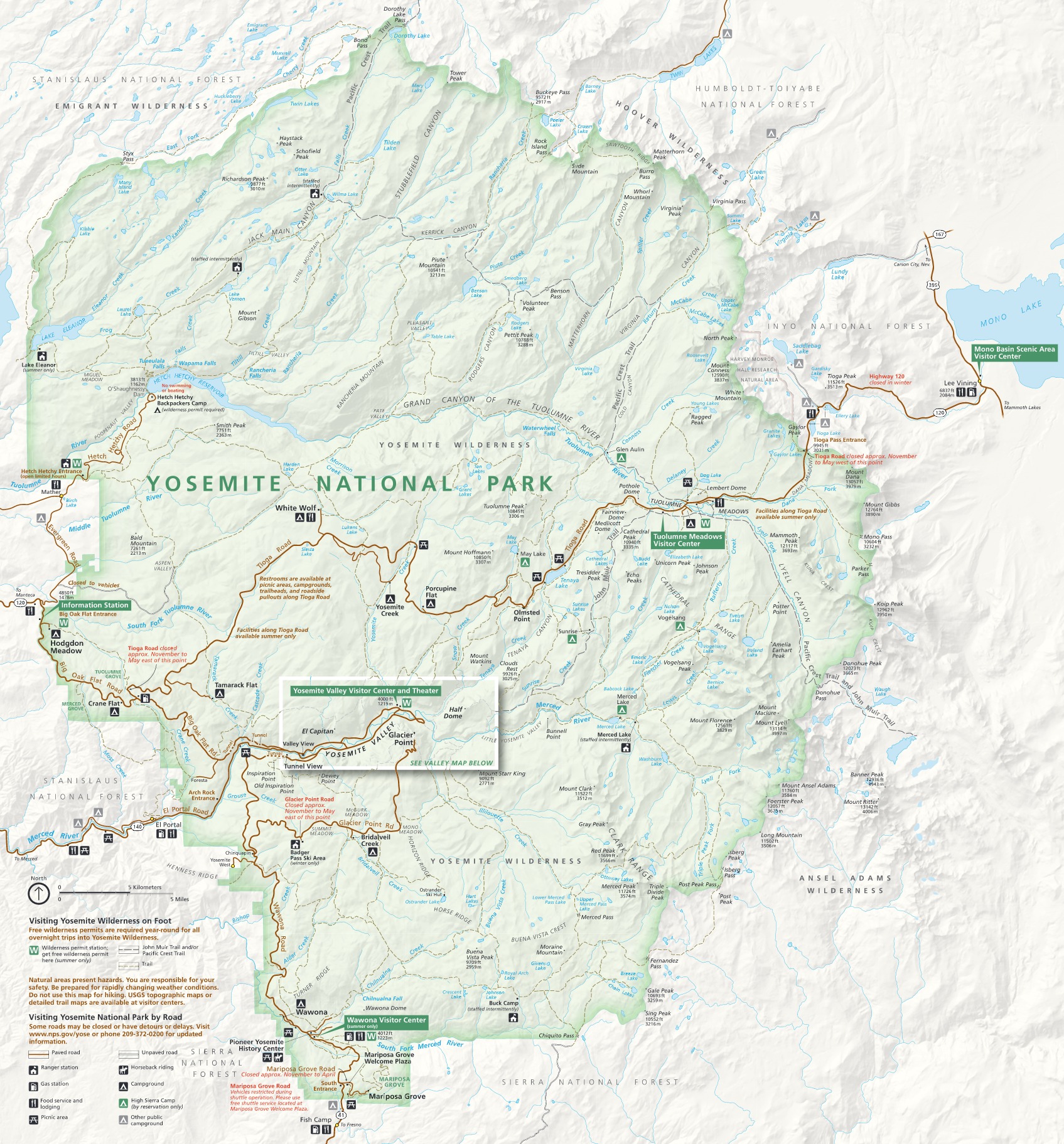
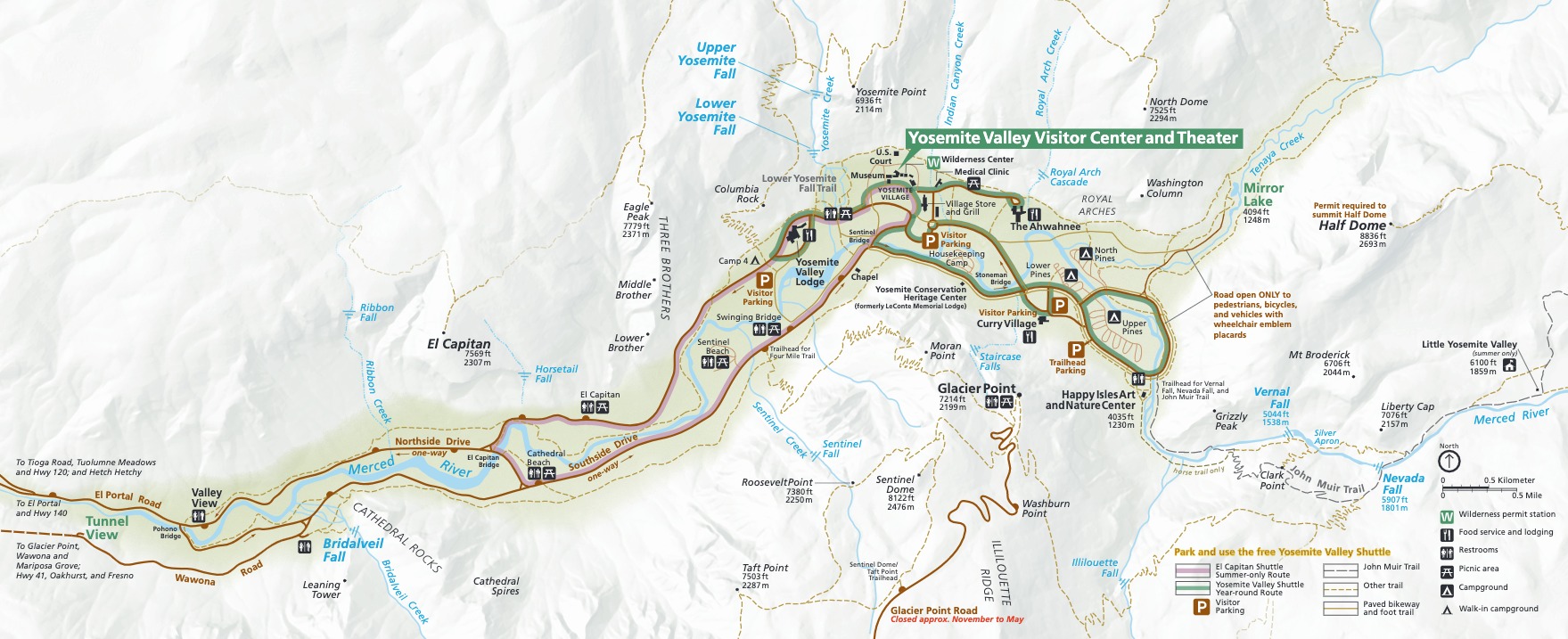
Official Park Maps
Below are the official park maps provided by the National Park Service. You can view either the original PDF file or a simple JPEG image file (some of these files can be quite large). Note that while these maps are useful for general navigation around the park, if you plan to do any hiking, you should really have a proper Yosemite Trail Map.