- This page contains affiliate links. Purchases made through them may earn us a small fee.
Getting to Wrangell-St. Elias National Park
Driving to Wrangell-St. Elias
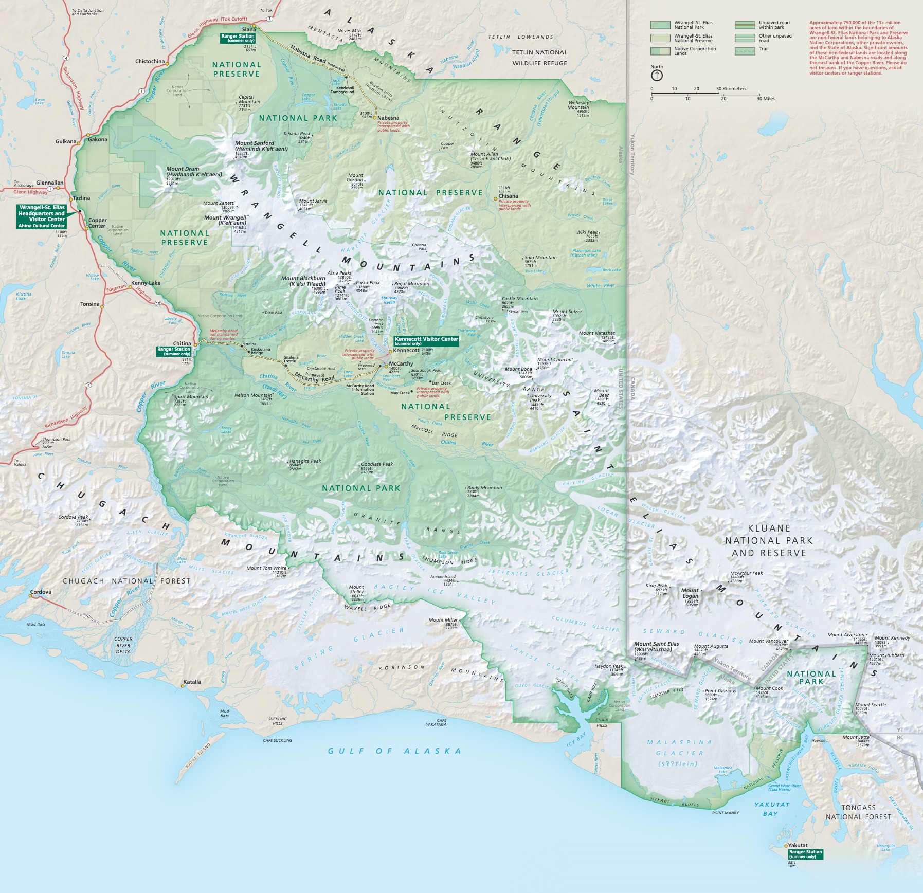
Wrangell-St. Elias is accessible via AK-4 (the Richardson Highway), and AK-1 (the Tok Cutoff). Access within the park is mostly limited to gravel roads, boats, and airplanes.
If you’d like to plot directions from your location use the interactive map below. The marker shows the location of the Copper Center Visitor Center in Wrangell-St. Elias.
Flying to Wrangell-St. Elias
The only major airport in the area with major airline service and car rental is in Anchorage (ANC). Several regional airlines, including Alaska Airlines, offer daily service to some of the villages in the immediate area of the park.
Below you will find a listing of the two major airports in Alaska. For each airport we give useful links for further information on the airport, as well as flight and rental car bookings. These links already have the destination airport selected for your convenience. For price searches, simply enter your origin and dates.
Ted Stevens Anchorage International Airport (ANC)
Anchorage flight schedule and price search
Anchorage available rental cars and price search
Fairbanks International Airport (FAI)
Fairbanks flight schedule and price search
Fairbanks available rental cars and price search
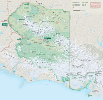
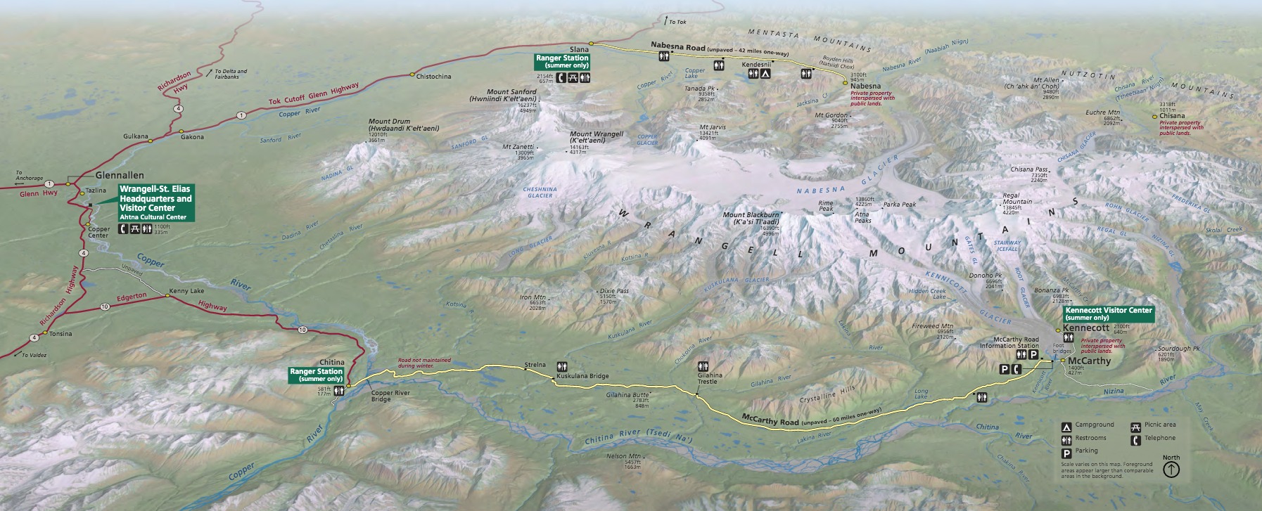
Official Park Maps
Below are the official park maps provided by the National Park Service. You can view either the original PDF file or a simple JPEG image file (some of these files can be quite large). Note that while these maps are useful for general navigation around the park, if you plan to do any hiking, you should really have a proper Wrangell-St. Elias Trail Map.
