Generals Highway (Part 2)
The Generals Highway runs from the Ash Mountain Entrance in the south part of Sequoia to the Kings Canyon Scenic Drive in Kings Canyon, passing through Sequoia National Forest on the way. We cover this road in three sections. The second part, from Crystal Cave Road to the national forest boundary, is covered below. For the previous part, from the Ash Mountain Entrance to Crystal Cave Road, see Generals Highway Part 1. For the last part, from the national forest boundary to the road’s end at the Kings Canyon Scenic Drive, see Generals Highway Part 3.
Mile 14.9 – First sequoias
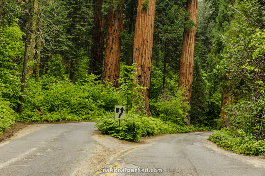
The road splits around a group of sequoia trees. They are an impressive sight, but there is nowhere to pull over to view them, and stopping in this section of road is, at the least, rude, and at the most, dangerous. There will be plenty more very soon.
Mile 16.6 – Giant Forest Museum & more
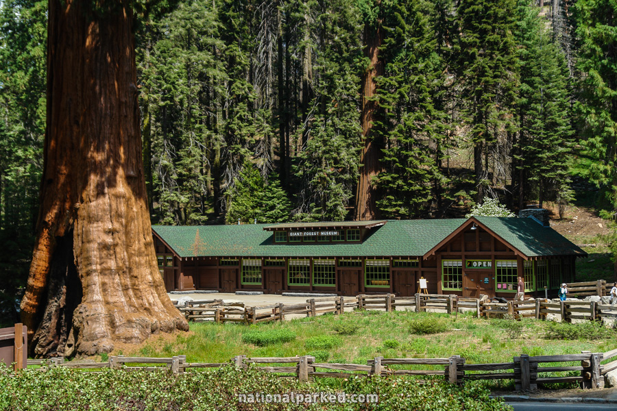
The road arrives at the Giant Forest Museum and a host of other features. This is one of the busiest areas in the park. In addition to the museum is the accessible Big Trees Trail and the road to Moro Rock, Crescent Meadow, and the Tunnel Log. Moro Rock is a relatively easy climb to an outstanding vista and is highly recommended. For more on the trails in this area, see Sequoia & Kings Canyon Hiking.
Mile 16.9 – Big Trees Trailhead
Limited parking on the left is available for the Big Trees Trail mentioned above. It is for handicapped signed vehicles only.
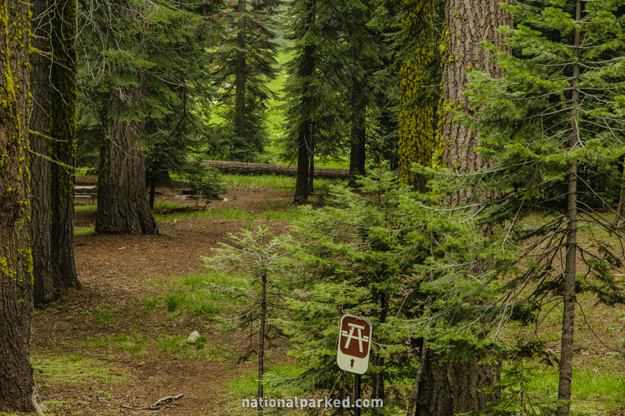
Mile 17.7 – Pinewood Picnic Area
The road passes by the Pinewood Picnic Area on the left.
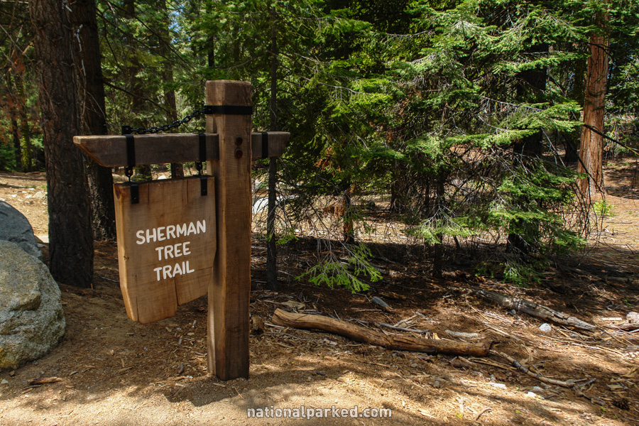
Mile 18.8 – Sherman Tree lower parking
A small parking area is on the right, for the General Sherman Tree. Again, this is for handicapped signed vehicles only. The Giant Forest Shuttle also stops here. The official Sherman Tree Trail starts above at the main Sherman Tree Parking Area and descends somewhat steeply to the tree. A good option for those not wanting to hike uphill is to walk down to the tree and take the shuttle back to the parking area above.
Mile 19.4 – Sherman Tree Road
A road to the right leads to the Sherman Tree Trail parking area described just above, and on to Wolverton. The Congress Trail and the longer Trail of the Sequoias also start from here, and one or all of these are nearly required hikes. For more on the trails see Sequoia & Kings Canyon Hiking.
Mile 21.0 – Lodgepole Area
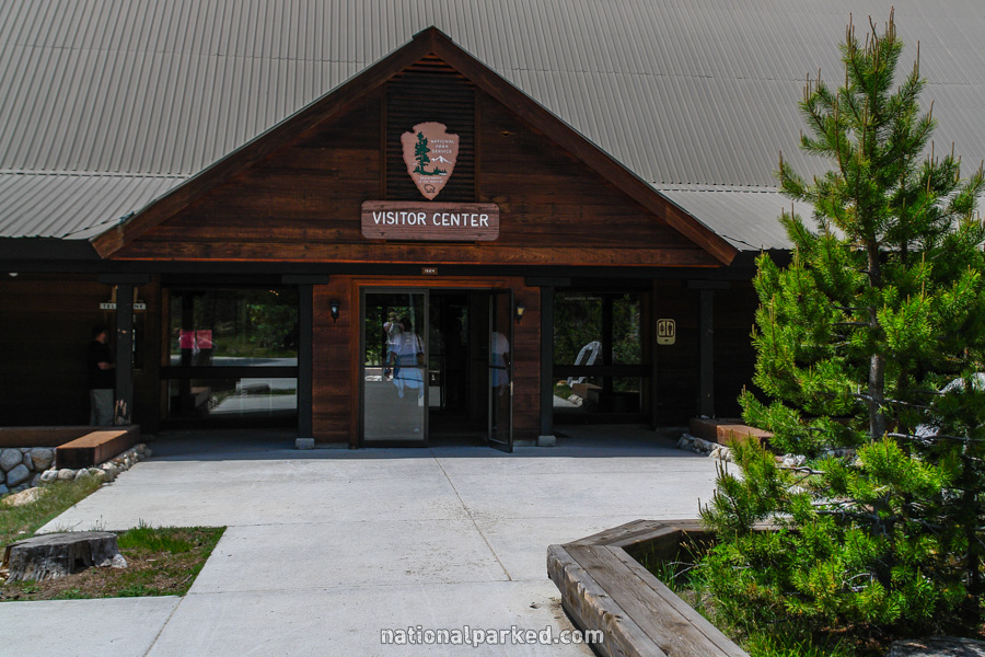
A road on the right leads to the Lodgepole area, which includes a visitor center and the Lodgepole Campground, a large campground typically open all year.
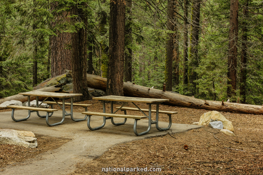
Mile 21.2 – Lodgepole Picnic Area
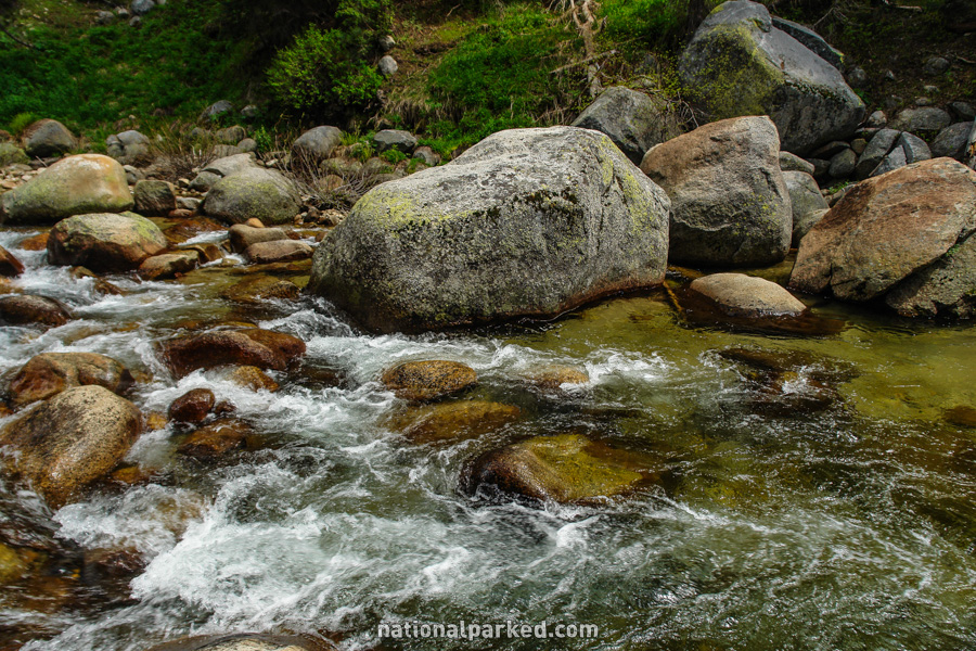
Just past the bridge is a small picnic area on the left. More notable than the picnic area is the easy access to a beautiful section of the Marble Fork of the Kaweah River.
Mile 22.7 – Wuksachi Village
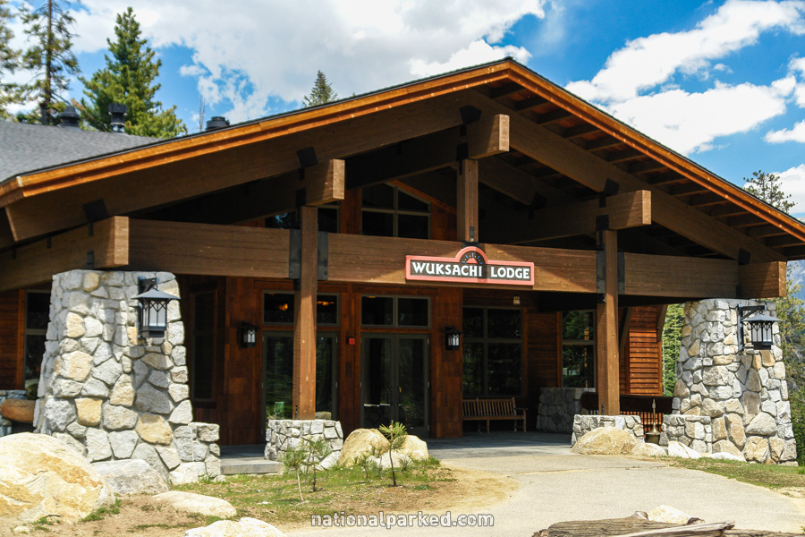
The side road to Wuksachi Village is on the right. The Wuksachi Lodge, the lone lodging available within Sequoia’s borders, is here. See Sequoia & Kings Canyon Lodging for more information.
Mile 24.8 – Halstead Meadows Picnic Area
The Halstead Meadows Picnic Area is on the left.
Mile 29.4 – Dorst Creek Campground
The access road to Dorst Creek Campground is on the left.
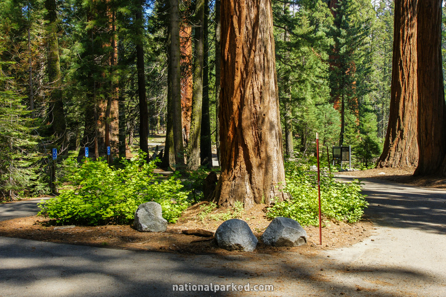
Mile 32.0 – Roadside sequoias
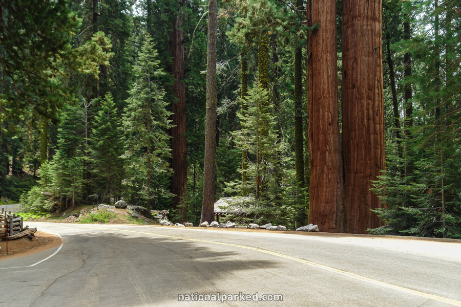
Long pulloffs on both sides of the road provide parking for an impressive area of sequoias right along the road. Informal trails on the left side provide a closer look. Fences have been erected on the right side to protect the sensitive roots of the trees. You might see people on the other sides of these fences; please do not duplicate their carelessness.
Mile 32.7 – Sequoia National Forest
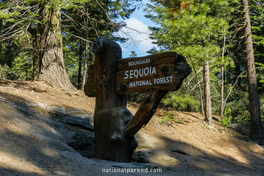
The road leaves Sequoia National Park and enters Sequoia National Forest. It winds through the national forest for the next 10.5 miles before entering Kings Canyon National Park.
The Generals Highway Continues On
For the next section, from the national forest boundary to the road’s end at the Kings Canyon Scenic Drive, see Generals Highway Part 3.