- This page contains affiliate links. Purchases made through them may earn us a small fee.
Getting to Kenai Fjords National Park
Driving to Kenai Fjords
Kenai Fjords lies near the town of Seward, which is a 126 mile, three hour drive from Anchorage. The Exit Glacier area is the only part of the part accessible by road. It is at the end of an eight mile road off of the Seward Highway.
If you’d like to plot directions from your location use the interactive map below. The marker shows the location of the Exit Glacier Visitor Center in Kenai Fjords.
Flying to Kenai Fjords
Below you will find a listing of the two major airports in Alaska. For Kenai Fjords, Anchorage is the obvious choice unless you’re also visiting some of the northern national parks in the state. For each airport we give useful links for further information on the airport, as well as flight and rental car bookings. These links already have the destination airport selected for your convenience. For price searches, simply enter your origin and dates.
Ted Stevens Anchorage International Airport (ANC)
Anchorage flight schedule and price search
Anchorage available rental cars and price search
Fairbanks International Airport (FAI)
Fairbanks flight schedule and price search
Fairbanks available rental cars and price search
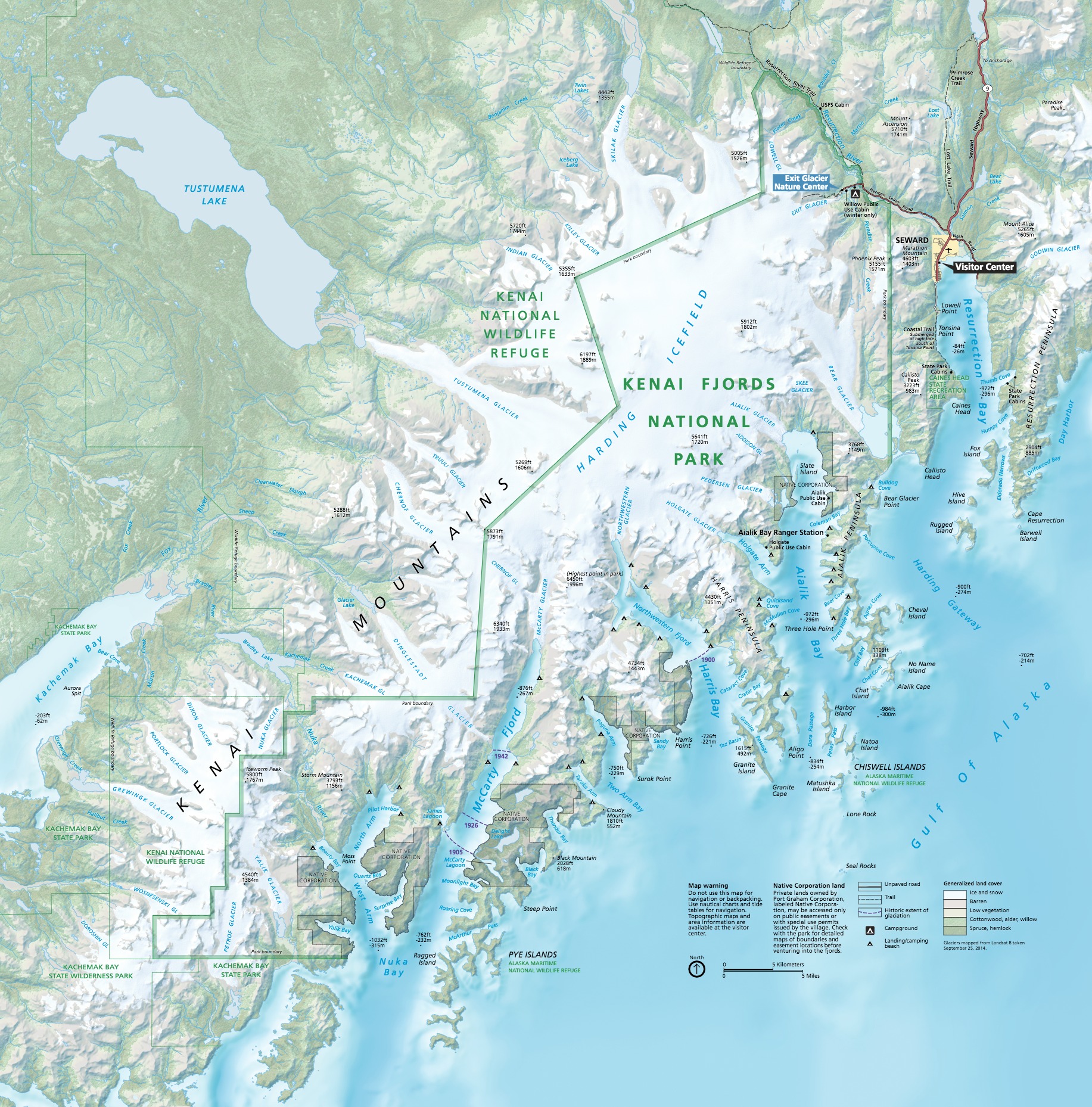
Official Park Map
Below is the official park map provided by the National Park Service. You can view either the original PDF file or a simple JPEG image file (some of these files can be quite large). Note that while this map is useful for general navigation around the park, if you plan to do any hiking, you should really have a proper Kenai Fjords Trail Map.
