- This page contains affiliate links. Purchases made through them may earn us a small fee.
Getting to Everglades National Park
Driving to Everglades
To reach the Flamingo area, take the Florida Turnpike south until it merges with US-1. Turn right onto Palm Drive and follow the signs to the park. To reach the Shark Valley Visitor Center take exit 25 from the Florida Turnpike to Highway 41, the Tamiami Trail, for 25 miles west.
If you’d like to plot directions from your location use the interactive map below. The marker shows the location of the Ernest F. Coe Visitor Center in Everglades.
Flying to Everglades
Below you will find a list of airports most convenient for a trip to Everglades, listed in order of distance. For each airport we provide direct links to browse available flights and cars. For price searches, simply enter your origin and dates.
Miami International Airport (MIA)
Located in Miami, Florida, 43 miles by car to Everglades
Miami flight schedule and price search
Miami available rental cars and price search
Fort Lauderdale-Hollywood International Airport (FLL)
Located in Fort Lauderdale, Florida, 72 miles by car to Everglades
Fort Lauderdale flight schedule and price search
Fort Lauderdale available rental cars and price search
Palm Beach International Airport (PBI)
Located in West Palm Beach, Florida, 114 miles by car to Everglades
West Palm Beach flight schedule and price search
West Palm Beach available rental cars and price search
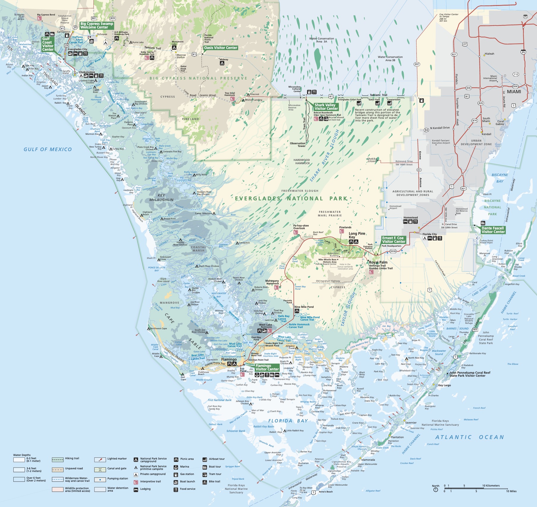
Official Park Map
Below is the official park map provided by the National Park Service. You can view either the original PDF file or a simple JPEG image file (some of these files can be quite large). Note that while this map is useful for general navigation around the park, if you plan to do any hiking, you should really have a proper Everglades Trail Map.
