- This page contains affiliate links. Purchases made through them may earn us a small fee.
Getting to Death Valley National Park
Death Valley National Park covers an enormous area, mostly in California, with a small section in Nevada. It is in a very remote area, with few towns and even fewer services. Beatty, Nevada is a reasonable distance from the popular Furnace Creek area.
Driving to Death Valley
CA-190 runs roughly east and west through the park, connecting to US-395 in the west and US-95 in the east. US-95 heads south to Las Vegas.
If you’d like to plot directions from your location use the interactive map below. The marker shows the location of the Furnace Creek Visitor Center in Death Valley.
Flying to Death Valley
Death Valley is in the middle of nowhere. Even the closest airport, Las Vegas, is over two hours away. If you’re looking for high volume and cheap price, both Las Vegas and Los Angeles are good bets. St. George is mostly of interest to those also visiting Zion or other southern Utah parks.
Below you will find a list of airports most convenient for a trip to Death Valley, listed in order of distance. For each airport we provide direct links to browse available flights and cars. For price searches, simply enter your origin and dates.
Harry Reid International Airport (LAS)
Located in Las Vegas, NV, 119 miles by car to Death Valley (Furnace Creek)
Las Vegas flight schedule and price search
Las Vegas available rental cars and price search
St. George Regional Airport (SGU)
Located in St. George, Utah, 260 miles by car to Death Valley (Furnace Creek)
St. George flight schedule and price search
St. George available rental cars and price search
Los Angeles International Airport (LAX)
Located in Los Angeles, California, 274 miles by car to Death Valley (Furnace Creek)
Los Angeles flight schedule and price search
Los Angeles available rental cars and price search
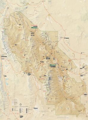
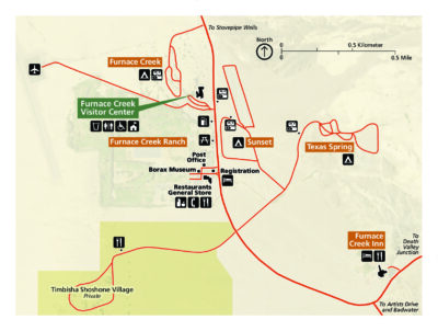
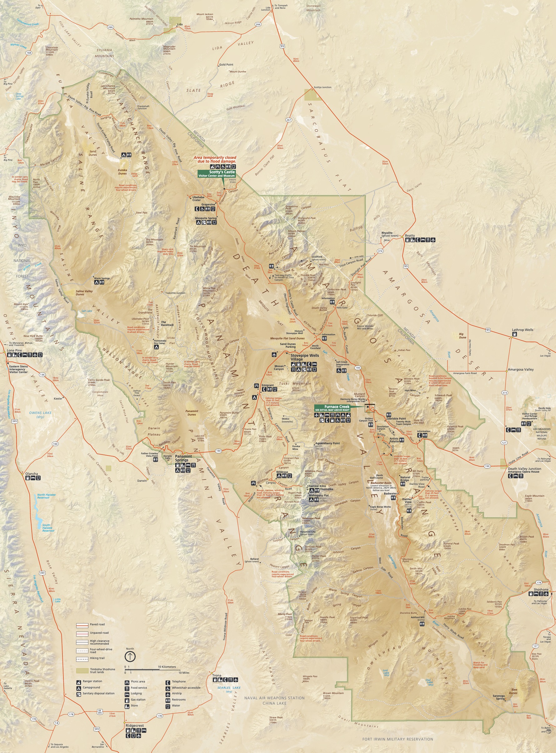
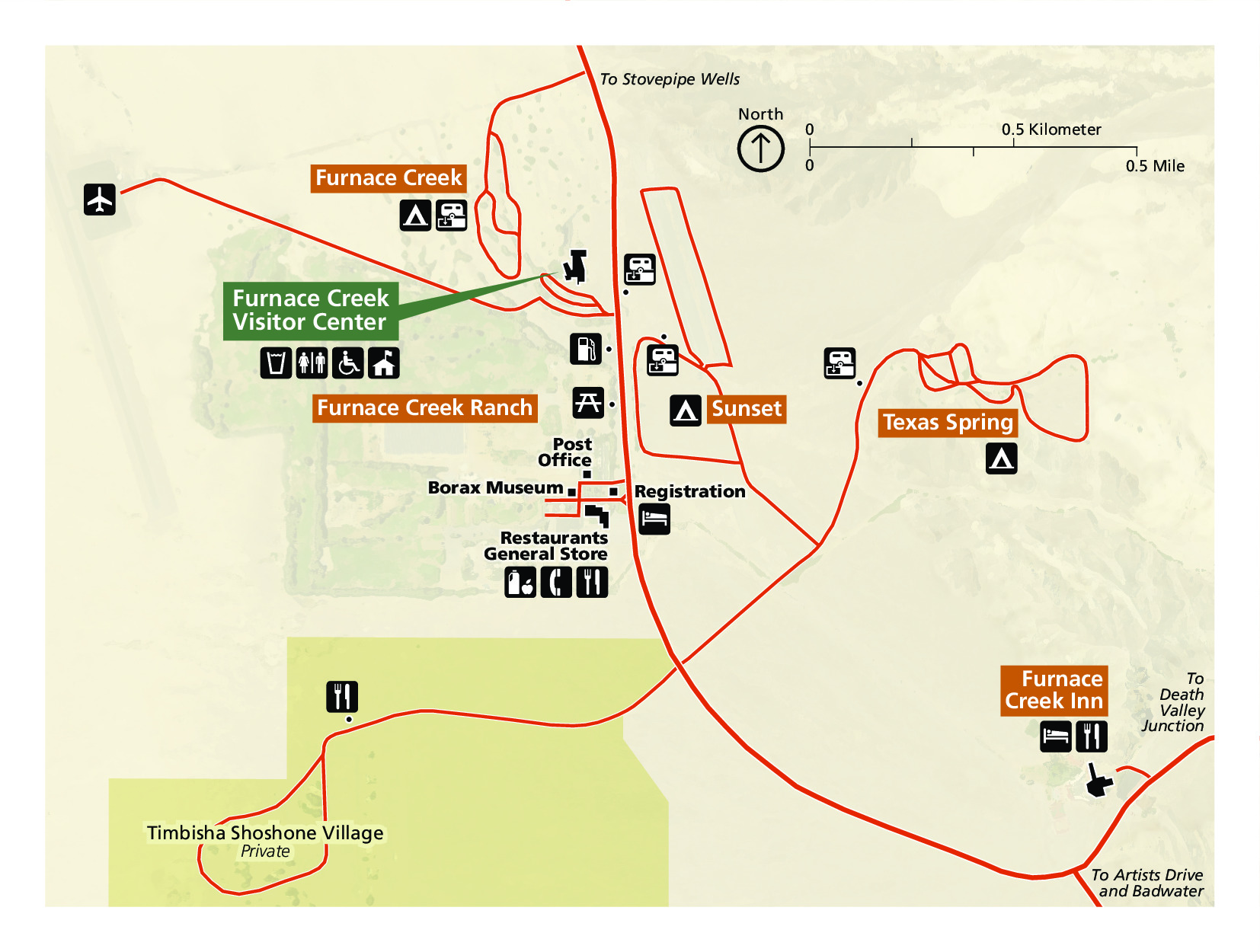
Official Park Maps
Below are the official park maps provided by the National Park Service. You can view either the original PDF file or a simple JPEG image file (some of these files can be quite large). Note that while these maps are useful for general navigation around the park, if you plan to do any hiking, you should really have a proper Death Valley Trail Map.