- This page contains affiliate links. Purchases made through them may earn us a small fee.
Getting to Channel Islands National Park
Driving to Channel Islands
To get to the visitor center, located on the mainland, use US-101. Northbound, take the Victoria Avenue exit, turn left on Victoria, turn right onto Olivas Park Drive which becomes Spinnaker Drive. The visitor center is located at the end of Spinnaker Drive in the Ventura Harbor. Southbound, take the Seaward Avenue exit, turn left onto Harbor Boulevard, then turn right onto Spinnaker Drive.
If you’d like to plot directions from your location use the interactive map below. The marker shows the location of the Robert J. Lagomarsino Visitor Center in Ventura.
Flying to Channel Islands
Southern California has airports scattered all over the place. Below we list the three most convenient, but there are several others. LAX will be, by far, the airport with the most selection, and likely the lowest prices.
Below you will find a list of airports most convenient for a trip to Channel Islands, listed in order of distance. For each airport we provide direct links to browse available flights and cars. For price searches, simply enter your origin and dates.
Santa Barbara Municipal Airport (SBA)
Located in Santa Barbara, California, 42 miles by car to Channel Islands (visitor center)
Santa Barbara flight schedule and price search
Santa Barbara available rental cars and price search
Burbank Bob Hope Airport (BUR)
Located in Burbank, California, 61 miles by car to Channel Islands (visitor center)
Burbank flight schedule and price search
Burbank available rental cars and price search
Los Angeles International Airport (LAX)
Located in Los Angeles, California, 68 miles by car to Channel Islands (visitor center)
Los Angeles flight schedule and price search
Los Angeles available rental cars and price search
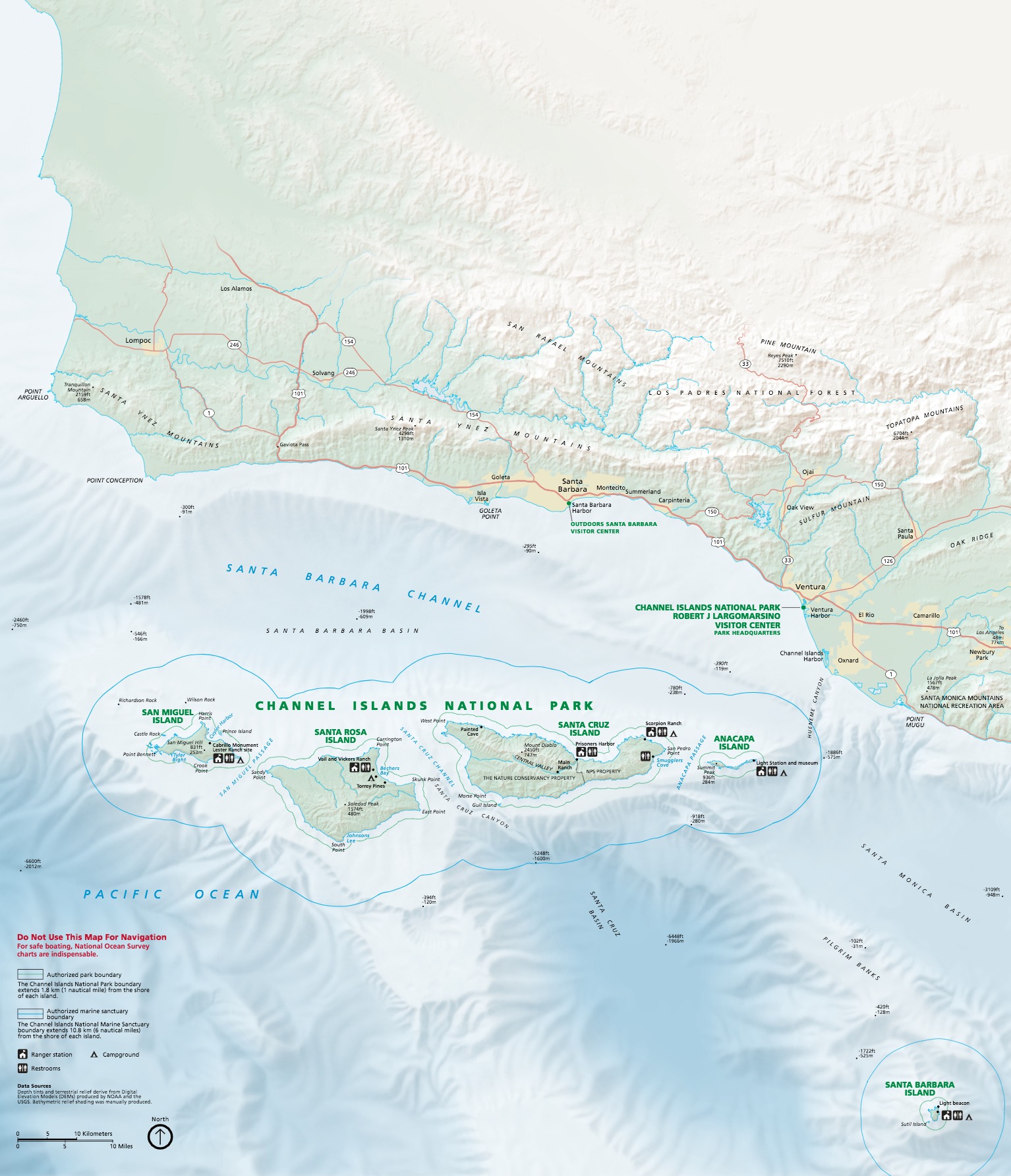
Official Park Map
Below is the official park map provided by the National Park Service. You can view either the original PDF file or a simple JPEG image file (some of these files can be quite large). Note that while this map is useful for general navigation around the park, if you plan to do any hiking, you should really have a proper Channel Islands Trail Map.
