- This page contains affiliate links. Purchases made through them may earn us a small fee.
Getting to Bryce Canyon National Park
Driving to Bryce Canyon
Road access to the main part of Bryce Canyon is via Utah Highway 63, which becomes the Bryce Canyon Road at the border. Utah Highway 12 leads to 63. Visitors coming from the north and Interstate 70 should take Exit 23 onto US Highway 89 south for 67 miles. From there UT-12 leads 13 miles to UT-63 and the entrance. From the west and Interstate 15, take Exit 95 to UT-20 for 20 miles to US-89 as above. Those coming from the east and Capitol Reef National Park can take the highly scenic UT-12 west from Torrey, UT for 109 miles to UT-63.
If you’d like to plot directions from your location use the interactive map below. The marker shows the location of the Visitor Center in Bryce Canyon.
Flying to Bryce Canyon
Bryce Canyon is in a remote area of southern Utah, placed almost strategically to be as far as possible from the closest airports. St. George is most convenient, but Salt Lake City and especially Las Vegas will likely be much cheaper.
Below you will find a list of airports most convenient for a trip to Bryce Canyon, listed in order of distance. For each airport we provide direct links to browse available flights and cars. For price searches, simply enter your origin and dates.
St. George Regional Airport (SGU)
Located in St. George, Utah, 143 miles by car to Bryce Canyon
St. George flight schedule and price search
St. George available rental cars and price search
Harry Reid International Airport (LAS)
Located in Las Vegas, NV, 270 miles by car to Bryce Canyon
Las Vegas flight schedule and price search
Las Vegas available rental cars and price search
Salt Lake City International Airport (SLC)
Located in Salt Lake City, Utah, 273 miles by car to Bryce Canyon
Salt Lake City flight schedule and price search
Salt Lake City available rental cars and price search
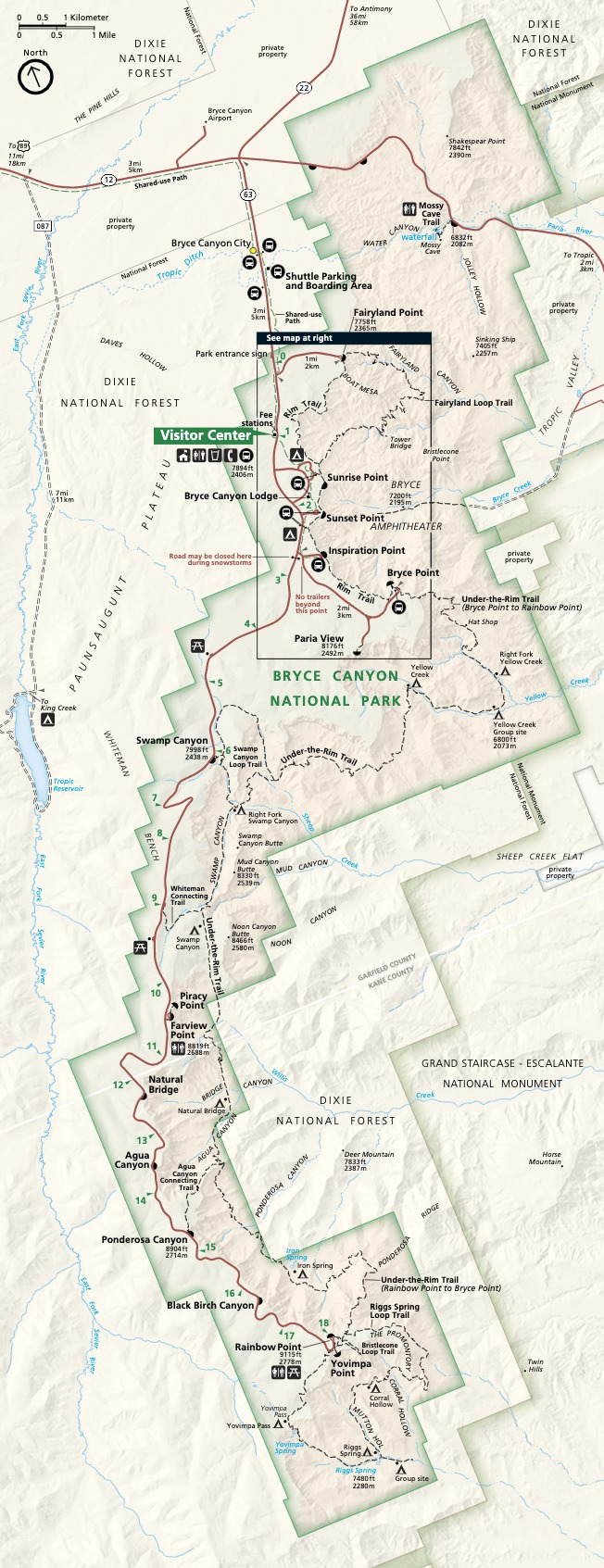
Official Park Map
Below is the official park map provided by the National Park Service. You can view either the original PDF file or a simple JPEG image file (some of these files can be quite large). Note that while this map is useful for general navigation around the park, if you plan to do any hiking, you should really have a proper Bryce Canyon Trail Map.