- This page contains affiliate links. Purchases made through them may earn us a small fee.
Getting to Black Canyon of the Gunnison
Black Canyon of the Gunnison National Park is located in west-central Colorado, where the Gunnison River has cut a deep and narrow canyon. Visits to both the north and south rim are possible, though the south rim is more developed and sees the large majority of visitors. The city of Montrose, just a few miles from the south rim, is the closest city of size.
Driving to Black Canyon of the Gunnison
To get to the South Rim, take US50 east from Montrose about 6 miles and turn left on CO-347. Follow this north about 7 miles to the park entrance. To reach the North Rim, follow Black Canyon Road and the unpaved North Rim Road for about 15 miles south of Crawford.
If you’d like to plot directions from your location use the interactive map below. The marker shows the location of the South Rim Visitor Center in Black Canyon of the Gunnison.
Flying to Black Canyon of the Gunnison
The park’s gateway city, Montrose, has a small regional airport with limited commercial service. Grand Junction has more, and Denver is a full service international airport, though quite distant.
Below you will find a list of airports most convenient for a trip to Black Canyon of the Gunnison, listed in order of distance. For each airport we provide direct links to browse available flights and cars. For price searches, simply enter your origin and dates.
Montrose Regional Airport (MTJ)
Located in Montrose, Colorado, 15 miles by car to Black Canyon’s South Rim
Montrose flight schedule and price search
Montrose available rental cars and price search
Grand Junction Regional Airport (GJT)
Located in Grand Junction, Colorado, 79 miles by car to Black Canyon’s South Rim
Grand Junction flight schedule and price search
Grand Junction available rental cars and price search
Denver International Airport (DEN)
Located well east of Denver, Colorado, 279 miles by car to Black Canyon’s South Rim
Denver flight schedule and price search
Denver available rental cars and price search
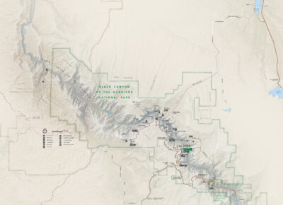
Official Park Map
Below is the official park map provided by the National Park Service. You can view either the original PDF file or a simple JPEG image file (some of these files can be quite large). Note that while this map is useful for general navigation around the park, if you plan to do any hiking, you should really have a proper Black Canyon of the Gunnison Trail Map.