- This page contains affiliate links. Purchases made through them may earn us a small fee.
Getting to Acadia National Park
Driving to Acadia
Most people come from the south. Take I-95 north to the city of Augusta, then take ME-3 east through Ellsworth to Mount Desert Island, where most of the park is located. For another route, continue on I-95 north to Bangor, then take ME-1A east to Ellsworth, then join ME-3 as above on to the park.
If you’d like to plot directions from your location use the interactive map below. The marker shows the location of the Hulls Cove Visitor Center in Acadia.
Flying to Acadia
Acadia is isolated from other national parks, up in the far northeast of the United States. From most places, it makes sense to fly and make Acadia your main destination.
Below you will find a list of airports most convenient for a trip to Acadia, listed in order of distance. For each airport we provide direct links to browse available flights and cars. For price searches, simply enter your origin and dates.
Bangor International Airport (BGR)
Located in Bangor, Maine, 46 miles by car to Acadia
Bangor flight schedule and price search
Bangor available rental cars and price search
Portland International Jetport (PWM)
Located in Portland, Maine, 173 miles by car to Acadia
Portland flight schedule and price search
Portland available rental cars and price search
Boston Logan International Airport (BOS)
Located in Boston, Massachusetts, 276 miles by car to Acadia
Boston flight schedule and price search
Boston available rental cars and price search
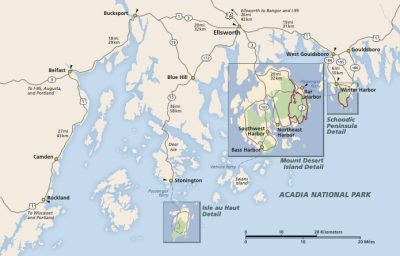
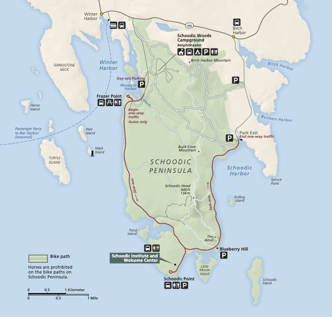
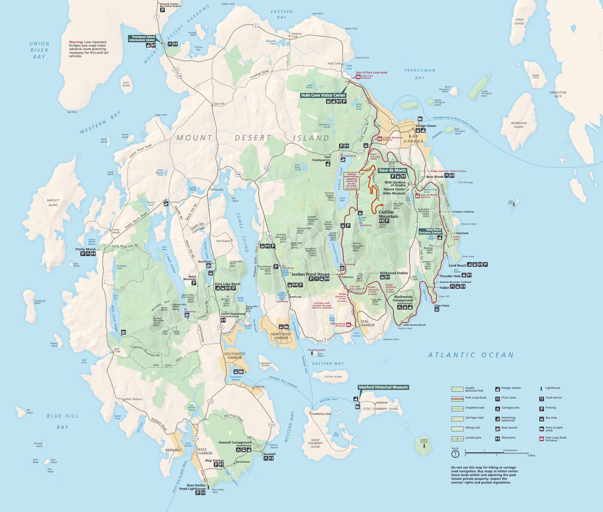
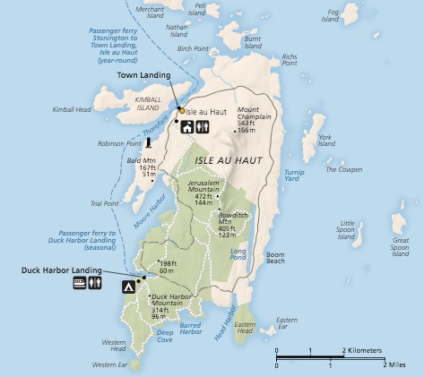
Official Park Maps
Below are the official park maps provided by the National Park Service. You can view either the original PDF file or a simple JPEG image file (some of these files can be quite large). Note that while these maps are useful for general navigation around the park, if you plan to do any hiking, you should really have a proper Acadia Trail Map.

